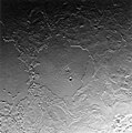
Tiedosto:PIA01538 Complex Geologic History of Triton.jpg
Siirry navigaatioon
Siirry hakuun

Tämän esikatselun koko: 594 × 600 kuvapistettä. Muut resoluutiot: 238 × 240 kuvapistettä | 475 × 480 kuvapistettä | 761 × 768 kuvapistettä | 1 014 × 1 024 kuvapistettä | 1 885 × 1 903 kuvapistettä.
Alkuperäinen tiedosto (1 885 × 1 903 kuvapistettä, 452 KiB, MIME-tyyppi: image/jpeg)
Tiedoston historia
Päiväystä napsauttamalla näet, millainen tiedosto oli kyseisellä hetkellä.
| Päiväys | Pienoiskuva | Koko | Käyttäjä | Kommentti | |
|---|---|---|---|---|---|
| nykyinen | 21. huhtikuuta 2015 kello 10.46 |  | 1 885 × 1 903 (452 KiB) | Jcpag2012 | flipped vertically, NASA photo |
| 21. huhtikuuta 2015 kello 10.40 |  | 1 885 × 1 903 (451 KiB) | Jcpag2012 | Reverted to version as of 02:57, 16 August 2005 - NASA photo | |
| 2. tammikuuta 2010 kello 00.19 |  | 1 885 × 1 903 (634 KiB) | Supportstorm | Image Adjustments: Auto levels on contrast and color | |
| 16. elokuuta 2005 kello 05.57 |  | 1 885 × 1 903 (451 KiB) | PedroPVZ | {{en}} Tritan basins {{pt}} crateras em Tritão {{PD-USGov-NASA}} category:Triton (moon) |
Tiedoston käyttö
Seuraava sivu käyttää tätä tiedostoa:
Tiedoston järjestelmänlaajuinen käyttö
Seuraavat muut wikit käyttävät tätä tiedostoa:
- Käyttö kohteessa af.wikipedia.org
- Käyttö kohteessa cs.wikipedia.org
- Käyttö kohteessa de.wikipedia.org
- Käyttö kohteessa en.wikipedia.org
- Käyttö kohteessa eo.wikipedia.org
- Käyttö kohteessa es.wikipedia.org
- Käyttö kohteessa fr.wikipedia.org
- Käyttö kohteessa hy.wikipedia.org
- Käyttö kohteessa it.wikipedia.org
- Käyttö kohteessa ja.wikipedia.org
- Käyttö kohteessa lb.wikipedia.org
- Käyttö kohteessa mk.wikipedia.org
- Käyttö kohteessa mwl.wikipedia.org
- Käyttö kohteessa no.wikipedia.org
- Käyttö kohteessa oc.wikipedia.org
- Käyttö kohteessa pt.wikipedia.org
- Käyttö kohteessa ro.wikipedia.org
- Käyttö kohteessa si.wikipedia.org
- Käyttö kohteessa sv.wikipedia.org
- Käyttö kohteessa test.wikipedia.org
- Käyttö kohteessa vi.wikipedia.org
- Käyttö kohteessa www.wikidata.org
- Käyttö kohteessa zh.wikipedia.org


