Tiedosto:Us canada eu 2007.png
Siirry navigaatioon
Siirry hakuun
Tarkempaa kuvaa ei ole saatavilla.
Us_canada_eu_2007.png (738 × 375 kuvapistettä, 20 KiB, MIME-tyyppi: image/png)
| Tämä tiedosto on tiedostotietokanta Wikimedia Commonsista. Tiedot kuvaussivulta näkyvät alla. |  |
Tiedoston kuvaussivu Commonsissa |
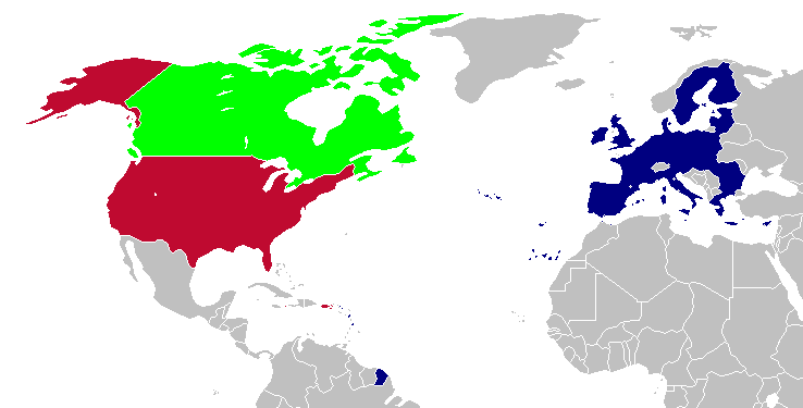
Yhteenveto
This is a map of the US, Canada and the EU for use after Romania and Bulgaria join the EU in 2007. The map is the same as en:Image:Us canada eu.png; however French Guiana and Puerto Rico have been added. This map is based off of Image:BlankMap-World-v5-EU.png.
Lisenssi

|
Voit kopioida, levittää ja/tai muuttaa tätä asiakirjaa GNU Free Documentation License -lisenssin version 1.2 tai minkä tahansa Free Software Foundationin julkaiseman myöhemmän version ehtojen alaisena; ei koske muuttumattomia kohtia, etukannen tekstejä eikä takakannen tekstejä. Kopio tästä lisenssistä on saatavilla osiossa GNU Free Documentation License. |
| Tämä tiedosto on lisensoitu Creative Commons Nimeä-JaaSamoin 3.0 Ei sovitettu -lisenssillä. | ||
| ||
| Lisensointimerkintä lisätiin tähän tiedostoon osana GFDL-lisensointipäivitystä. |
| Tämän teoksen tekijä, Hoshie, on julkaissut sen public domainiin. Tämä on voimassa maailmanlaajuisesti. Joissain maissa laki ei mahdollista tätä. Mikäli näin on: |
Tiedoston historia
Päiväystä napsauttamalla näet, millainen tiedosto oli kyseisellä hetkellä.
| Päiväys | Pienoiskuva | Koko | Käyttäjä | Kommentti | |
|---|---|---|---|---|---|
| nykyinen | 13. huhtikuuta 2008 kello 02.28 | | 738 × 375 (20 KiB) | Hoshie | St. Barts and St. Martin are in the EU |
| 6. maaliskuuta 2007 kello 06.58 |  | 738 × 375 (20 KiB) | Hoshie | added more details of places in and out of the EU. | |
| 13. joulukuuta 2006 kello 23.51 |  | 703 × 363 (18 KiB) | Hoshie | Fixed an island off of Alaska. under same license as original. | |
| 18. marraskuuta 2006 kello 07.06 |  | 703 × 363 (18 KiB) | Hoshie | This is a map of the US, Canada and the EU for use after Romania and Bulgaria join the EU in 2007. The map is the same as en:Image:Us canada eu.png; however French Guiana and Puerto Rico have been added. This map is based off of [[:Image:BlankMap-Wor |
Tiedoston käyttö
Tätä tiedostoa ei käytetä millään sivulla.
Tiedoston järjestelmänlaajuinen käyttö
Seuraavat muut wikit käyttävät tätä tiedostoa:
- Käyttö kohteessa en.wikipedia.org
- Käyttö kohteessa es.wikipedia.org
- Käyttö kohteessa uk.wikipedia.org
- Käyttö kohteessa zh.wikipedia.org