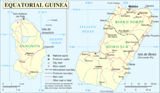
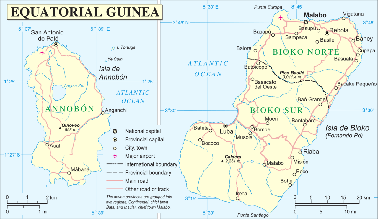
Tiedosto:Annobón Bioko.PNG

Alkuperäinen tiedosto (1 894 × 1 100 kuvapistettä, 502 KiB, MIME-tyyppi: image/png)
| Tämä tiedosto on tiedostotietokanta Wikimedia Commonsista. Tiedot kuvaussivulta näkyvät alla. |  |
Tiedoston kuvaussivu Commonsissa |
Yhteenveto
| Kuvaus | |
| Päiväys | |
| Lähde | http://www.un.org/Depts/Cartographic/map/profile/eqguinea.pdf |
| Tekijä | |
| Muut versiot |
Tämän tiedoston johdannaisteoksia: |
Lisenssi
| This image is a map derived from a United Nations map.
Unless stated otherwise, UN maps are to be considered in the public domain. This applies worldwide. UN maps are, in principle, open source material and you can use them in your work or for making your own map. UN requests however that you delete the UN name, logo and reference number upon any modification to the map. Content of your map will be your responsibility. You can state in your publication, if you wish, something like: based on UN map … (map name, map number, revision number and date). See: Geospatial Information Section. And: Geospatial, location data for a better world. |
 |
Tiedoston historia
Päiväystä napsauttamalla näet, millainen tiedosto oli kyseisellä hetkellä.
| Päiväys | Pienoiskuva | Koko | Käyttäjä | Kommentti | |
|---|---|---|---|---|---|
| nykyinen | 15. kesäkuuta 2016 kello 22.12 | | 1 894 × 1 100 (502 KiB) | W like wiki | + lower margin |
| 15. kesäkuuta 2016 kello 20.26 |  | 1 895 × 1 098 (501 KiB) | W like wiki | Now all coordinates are more clear: E for EAST, N for NORTH, S for SOUTH !!! | |
| 15. kesäkuuta 2016 kello 20.04 |  | 1 895 × 1 098 (500 KiB) | W like wiki | link=|55px Even though the source of this file is the UN, the lower latitude coordinates of Annobón (located on the southern hemisphere!) seems to be '''wrong''', so '''1°27′''' is now used instead of '''1°23... | |
| 7. syyskuuta 2014 kello 14.05 |  | 1 895 × 1 098 (499 KiB) | Basquetteur | Corrected to amend wrong spelling of Bioko (Isla de Boiko in original UN map) and also uploading a higher resolution version | |
| 20. toukokuuta 2005 kello 06.47 |  | 946 × 553 (88 KiB) | Taichi | Mapa de Annobón y Bioko. Guinea Ecuatorial {{PD}} Fuente: http://www.un.org/Depts/Cartographic/map/profile/eqguinea.pdf |
Tiedoston käyttö
Tätä tiedostoa ei käytetä millään sivulla.
Tiedoston järjestelmänlaajuinen käyttö
Seuraavat muut wikit käyttävät tätä tiedostoa:
- Käyttö kohteessa an.wikipedia.org
- Käyttö kohteessa azb.wikipedia.org
- Käyttö kohteessa de.wikipedia.org
- Käyttö kohteessa en.wikipedia.org
- Käyttö kohteessa eo.wikipedia.org
- Käyttö kohteessa es.wikipedia.org
- Käyttö kohteessa et.wikipedia.org
- Käyttö kohteessa fr.wikipedia.org
- Käyttö kohteessa gl.wikipedia.org
- Käyttö kohteessa it.wikipedia.org
- Käyttö kohteessa ja.wikipedia.org
- Käyttö kohteessa ko.wikipedia.org
- Käyttö kohteessa ml.wikipedia.org
- Käyttö kohteessa pl.wikipedia.org
- Käyttö kohteessa pt.wikipedia.org
- Käyttö kohteessa ru.wikipedia.org
- Käyttö kohteessa sco.wikipedia.org
- Käyttö kohteessa sh.wikipedia.org
- Käyttö kohteessa uk.wikipedia.org
- Käyttö kohteessa ur.wikipedia.org
- Käyttö kohteessa vi.wikipedia.org
- Käyttö kohteessa wuu.wikipedia.org
- Käyttö kohteessa zh.wikipedia.org
- Käyttö kohteessa zu.wikipedia.org