Tiedosto:2022 United States Senate election in Georgia results map by county.svg
Siirry navigaatioon
Siirry hakuun

Tämän PNG-esikatselun koko koskien SVG-tiedostoa: 600 × 600 kuvapistettä. Muut resoluutiot: 240 × 240 kuvapistettä | 480 × 480 kuvapistettä | 768 × 768 kuvapistettä | 1 024 × 1 024 kuvapistettä | 2 048 × 2 048 kuvapistettä | 810 × 810 kuvapistettä.
Alkuperäinen tiedosto (SVG-tiedosto; oletustarkkuus 810 × 810 kuvapistettä; tiedostokoko 90 KiB)
| Tämä tiedosto on tiedostotietokanta Wikimedia Commonsista. Tiedot kuvaussivulta näkyvät alla. |  |
Tiedoston kuvaussivu Commonsissa |
Yhteenveto
| Kuvaus |
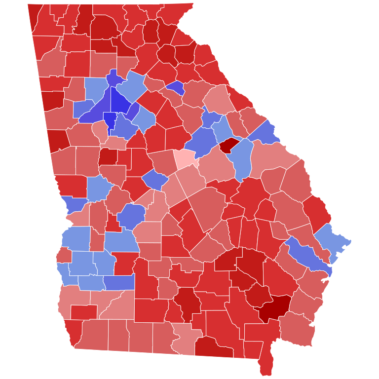
English: Results of the first round of the 2022 United States Senate election in Georgia by county. Data from https://www.nytimes.com/interactive/2022/11/08/us/elections/results-georgia-us-senate.html; results not certified yet. |
| Päiväys | |
| Lähde | Oma teos |
| Tekijä | PJRoRo |

Lisenssi
| This map is ineligible for copyright and therefore in the public domain, because it consists entirely of information that is common property and contains no original authorship. For more information, see Commons:Threshold of originality § Maps.
|
Tiedoston historia
Päiväystä napsauttamalla näet, millainen tiedosto oli kyseisellä hetkellä.
| Päiväys | Pienoiskuva | Koko | Käyttäjä | Kommentti | |
|---|---|---|---|---|---|
| nykyinen | 9. lokakuuta 2023 kello 23.42 | | 810 × 810 (90 KiB) | Putitonamap98 | Reverted to version as of 20:18, 23 July 2023 (UTC) now it does i fix the one mistake on runoff map. these are the standard shapes and dimensions |
| 26. elokuuta 2023 kello 16.24 |  | 744 × 744 (689 KiB) | DixiePolitics | Reverted to version as of 00:02, 22 July 2023 (UTC) General map needs to correspond with the Runoff map | |
| 23. heinäkuuta 2023 kello 23.18 |  | 810 × 810 (90 KiB) | CrookCoMaps61 | Fix | |
| 23. heinäkuuta 2023 kello 23.15 |  | 810 × 810 (89 KiB) | CrookCoMaps61 | Reverted to version as of 22:03, 14 July 2023 (UTC) | |
| 22. heinäkuuta 2023 kello 03.02 |  | 744 × 744 (689 KiB) | DixiePolitics | Reverted to version as of 13:14, 6 December 2022 (UTC) | |
| 15. heinäkuuta 2023 kello 01.03 |  | 810 × 810 (89 KiB) | Putitonamap98 | shapes | |
| 6. joulukuuta 2022 kello 16.14 |  | 744 × 744 (689 KiB) | Elli | meaningful county names | |
| 14. marraskuuta 2022 kello 02.42 |  | 744 × 744 (800 KiB) | PJRoRo | Uploaded own work with UploadWizard |
Tiedoston käyttö
Seuraava sivu käyttää tätä tiedostoa:
Tiedoston järjestelmänlaajuinen käyttö
Seuraavat muut wikit käyttävät tätä tiedostoa:
- Käyttö kohteessa en.wikipedia.org
- Käyttö kohteessa ja.wikipedia.org
- Käyttö kohteessa zh.wikipedia.org