Tiedosto:Historic American Buildings Survey Nathaniel R. Ewan, Photographer March 15, 1936 SOUTHEAST ELEVATION - Burlington County Courthouse, High Street, Mount Holly, Burlington County, HABS NJ,3-MOUHO,1-1.tif
Siirry navigaatioon
Siirry hakuun

Tämän JPG-esikatselun koko koskien TIF-tiedostoa: 800 × 558 kuvapistettä. Muut resoluutiot: 320 × 223 kuvapistettä | 640 × 446 kuvapistettä | 1 024 × 714 kuvapistettä | 1 280 × 893 kuvapistettä | 2 560 × 1 785 kuvapistettä | 4 609 × 3 214 kuvapistettä.
Alkuperäinen tiedosto (4 609 × 3 214 kuvapistettä, 14,13 MiB, MIME-tyyppi: image/tiff)
| Tämä tiedosto on tiedostotietokanta Wikimedia Commonsista. Tiedot kuvaussivulta näkyvät alla. |  |
Tiedoston kuvaussivu Commonsissa |
Yhteenveto
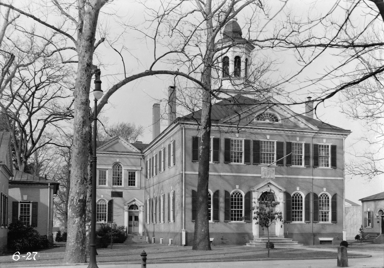
| Historic American Buildings Survey Nathaniel R. Ewan, Photographer March 15, 1936 SOUTHEAST ELEVATION - Burlington County Courthouse, High Street, Mount Holly, Burlington County, NJ | ||||
|---|---|---|---|---|
| Otsikko |
Historic American Buildings Survey Nathaniel R. Ewan, Photographer March 15, 1936 SOUTHEAST ELEVATION - Burlington County Courthouse, High Street, Mount Holly, Burlington County, NJ |
|||
| Kuvan esittämä paikka | New Jersey; Burlington County; Mount Holly | |||
| Mitat | 5 x 7 in. | |||
| Nykyinen sijainti |
Library of Congress Prints and Photographs Division Washington, D.C. 20540 USA http://hdl.loc.gov/loc.pnp/pp.print |
|||
| Tunniste |
HABS NJ,3-MOUHO,1-1 |
|||
| Kiitokset |
|
|||
| Lähde | https://www.loc.gov/pictures/item/nj0353.photos.111245p | |||
| Käyttöoikeus (Tämän tiedoston uudelleenkäyttö) |
|
|||

Tiedoston historia
Päiväystä napsauttamalla näet, millainen tiedosto oli kyseisellä hetkellä.
| Päiväys | Pienoiskuva | Koko | Käyttäjä | Kommentti | |
|---|---|---|---|---|---|
| nykyinen | 17. joulukuuta 2022 kello 16.49 |  | 4 609 × 3 214 (14,13 MiB) | Zeete | Cropped 8 % horizontally, 11 % vertically using CropTool with precise mode. |
| 29. heinäkuuta 2014 kello 15.32 |  | 5 000 × 3 604 (17,19 MiB) | Fæ | GWToolset: Creating mediafile for Fæ. HABS 24 July 2014 (2001:2300) |
Tiedoston käyttö
Seuraava sivu käyttää tätä tiedostoa:
Tiedoston järjestelmänlaajuinen käyttö
Seuraavat muut wikit käyttävät tätä tiedostoa:
- Käyttö kohteessa de.wikipedia.org
- Käyttö kohteessa en.wikipedia.org