Tiedosto:Custom House, Custom House Plaza, Monterey (Monterey County, California).jpg
Custom_House,_Custom_House_Plaza,_Monterey_(Monterey_County,_California).jpg (604 × 345 kuvapistettä, 67 KiB, MIME-tyyppi: image/jpeg)
| Tämä tiedosto on tiedostotietokanta Wikimedia Commonsista. Tiedot kuvaussivulta näkyvät alla. | .jpg?uselang=fi) |
Tiedoston kuvaussivu Commonsissa |
|
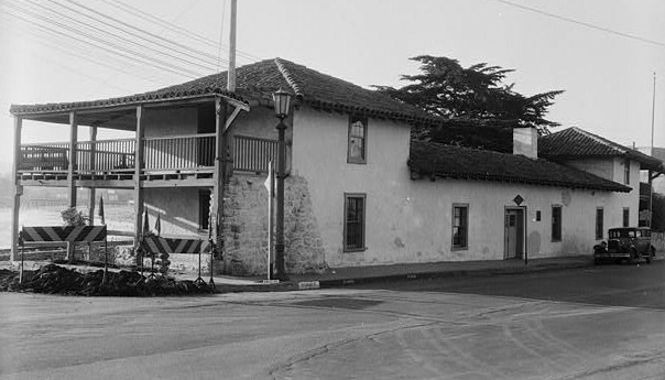
This is an image of a place or building that is listed on the National Register of Historic Places in the United States of America. Its reference number is 66000217. |
| Kuvaus |
Custom House, Custom House Plaza, Monterey (Monterey County, California) - (cropped). |
|||||
| Päiväys | ||||||
| Lähde | http://memory.loc.gov/cgi-bin/displayPhoto.pl?path=/pnp/habshaer/ca/ca0300/ca0380/photos&topImages=013690pr.jpg&topLinks=013690pv.jpg,013690pu.tif&title=10.%20%20Historic%20American%20Buildings%20Survey%20Robert%20W.%20Kerrigan%20-%20Photographer%20Photo%20Taken%3a%20May%2015,%201936%20VIEW%20FROM%20NORTHWEST%20%3cbr%3eHABS%20CAL,27-MONT,14-10&displayProfile=0 | |||||
| Tekijä | Robert W. Kerrigan - Photographer | |||||
| Käyttöoikeus (Tämän tiedoston uudelleenkäyttö) |
|

| Kohteen sijainti | | Tämä ja muut kuvat kartalla: OpenStreetMap |
|---|
.jpg¶ms=036.598056_N_-121.891944_E_globe:Earth_class:object_region:US_type:landmark_scale:1500_&language=fi)
Tämä teos ei saa tekijänoikeuden suojaa, koska tämä on Yhdysvaltain liittovaltion viranomaisen tekemä teos. Yhdysvaltain tekijänoikeuslain 105 § mukaisesti tällaisiin teoksiin ei ole tekijänoikeutta.
Tämä koskee vain liittovaltion viranomaisen tekemiä teoksia. Tämä ei koske osavaltion, territorion, piirikunnan, kunnan tai minkään muun pienemmän hallinnollisen alueen viranomaisten tekemiä teoksia. Yhdysvaltain postipalvelu pidättää oikeudet vuoden 1977 jälkeen julkaistuihin postimerkkeihin ([1]), joten tätä mallinetta ei voi käyttää myöskään niille. |
 | |
| Tämä teos on vapaa tunnetuista tekijänoikeuslain mukaisista rajoituksista, mukaanlukien lähioikeuksista. | ||
Tiedoston historia
Päiväystä napsauttamalla näet, millainen tiedosto oli kyseisellä hetkellä.
| Päiväys | Pienoiskuva | Koko | Käyttäjä | Kommentti | |
|---|---|---|---|---|---|
| nykyinen | 13. toukokuuta 2008 kello 20.06 | | 604 × 345 (67 KiB) | KudzuVine | {{Information |Description=Custom House, Custom House Plaza, Monterey (Monterey County, California)cropped) |Source=http://memory.loc.gov/cgi-bin/displayPhoto.pl?path=/pnp/habshaer/ca/ca0300/ca0380/photos&topImages=013690pr.jpg&topLinks=013690pv.jpg,01369 |
Tiedoston käyttö
Seuraava sivu käyttää tätä tiedostoa:
Tiedoston järjestelmänlaajuinen käyttö
Seuraavat muut wikit käyttävät tätä tiedostoa:
- Käyttö kohteessa azb.wikipedia.org
- Käyttö kohteessa de.wikipedia.org
- Käyttö kohteessa en.wikipedia.org
- Käyttö kohteessa eo.wikipedia.org
- Käyttö kohteessa fa.wikipedia.org
- Käyttö kohteessa fr.wikipedia.org
- Käyttö kohteessa it.wikipedia.org
- Käyttö kohteessa nl.wikipedia.org
- Käyttö kohteessa pt.wikipedia.org
- Käyttö kohteessa ru.wikipedia.org
.jpg)