Tiedosto:Azerbaijan adm location map.svg

Alkuperäinen tiedosto (SVG-tiedosto; oletustarkkuus 1 200 × 919 kuvapistettä; tiedostokoko 274 KiB)
| Tämä tiedosto on tiedostotietokanta Wikimedia Commonsista. Tiedot kuvaussivulta näkyvät alla. |  |
Tiedoston kuvaussivu Commonsissa |
Yhteenveto
| Kuvaus |
Deutsch: Positionskarte von Aserbaidschan
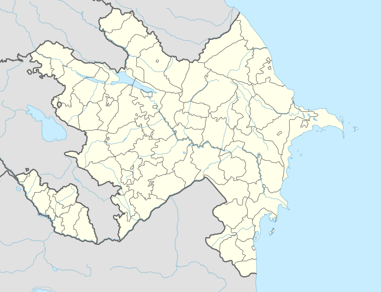
English: Location map of Azerbaijan
|
||||||||||||
| Päiväys | |||||||||||||
| Lähde |
Own work using:
|
||||||||||||
| Tekijä | NordNordWest | ||||||||||||
| Muut versiot |
|
||||||||||||
_location_map.svg)
_location_map.svg)

|
Saksankielisen Wikipedian projekti Kartenwerkstatt on parantanut tätä karttaa. Myös sinä voit ehdottaa jotakin karttaa parannettavaksi.
|
Lisenssi
Usage of this file with:

explanatory notes: Legally binding is only the full legalcode. For a free usage I recommend to respect the following licence conditions:
1. Provide my name as given above: NordNordWest,
2. a copy of, or the URI for, the applicable license: https://creativecommons.org/licenses/by-sa/3.0/de/legalcode,
3. the title of the work,
4. in the case of an adaptation, a credit identifying the use of the work in the adaptation.
This license and the rights granted hereunder will terminate automatically upon any breach by you of the terms of this license. Any of the above conditions can be waived if you get permission from the copyright holder. If you have questions or wish differing conditions, please contact me through nnwest or my discussion page ![]() t-online.de
t-online.de
- Voit:
- jakaa – kopioida, levittää ja esittää teosta
- remiksata – valmistaa muutettuja teoksia
- Seuraavilla ehdoilla:
- nimeäminen – Sinun on mainittava lähde asianmukaisesti, tarjottava linkki lisenssiin sekä merkittävä, mikäli olet tehnyt muutoksia. Voit tehdä yllä olevan millä tahansa kohtuullisella tavalla, mutta et siten, että annat ymmärtää lisenssinantajan suosittelevan sinua tai teoksen käyttöäsi.
- jaa samoin – Jos muutat tai perustat tähän työhön, voit jakaa tuloksena syntyvää työtä vain tällä tai tämän kaltaisella lisenssillä.

Tiedoston historia
Päiväystä napsauttamalla näet, millainen tiedosto oli kyseisellä hetkellä.
| Päiväys | Pienoiskuva | Koko | Käyttäjä | Kommentti | |
|---|---|---|---|---|---|
| nykyinen | 10. huhtikuuta 2024 kello 17.39 | | 1 200 × 919 (274 KiB) | NordNordWest | corr |
| 26. tammikuuta 2024 kello 23.51 |  | 1 200 × 919 (274 KiB) | NordNordWest | corr Ağdərə | |
| 7. lokakuuta 2023 kello 15.58 |  | 1 200 × 919 (273 KiB) | Nemoralis | this is in common usage | |
| 7. lokakuuta 2023 kello 15.31 |  | 1 200 × 919 (280 KiB) | Toghrul R | there's a separate file for this | |
| 2. lokakuuta 2023 kello 23.24 |  | 1 200 × 919 (273 KiB) | Qutlu | upd | |
| 20. huhtikuuta 2021 kello 22.18 |  | 1 200 × 919 (280 KiB) | NordNordWest | . | |
| 19. huhtikuuta 2021 kello 22.18 |  | 1 200 × 919 (286 KiB) | AntonSamuel | Further minor fixes | |
| 19. huhtikuuta 2021 kello 22.12 |  | 1 200 × 919 (286 KiB) | AntonSamuel | Stripes fix | |
| 19. huhtikuuta 2021 kello 18.58 |  | 1 200 × 919 (286 KiB) | AntonSamuel | Minor fix for Shusha | |
| 19. huhtikuuta 2021 kello 18.56 |  | 1 200 × 919 (286 KiB) | AntonSamuel | Further adjustments |
Tiedoston käyttö
Seuraavat 90 sivua käyttävät tätä tiedostoa:
- Askeran
- Astara (Azerbaidžan)
- Ağcabədi
- Ağdam
- Ağdaş
- Ağstafa
- Ağsu
- Aşağı Ağcakənd
- Baku
- Balakən
- Barxudarlı
- Beyləqan
- Biləsuvar
- Bərdə
- Culfa
- Cəbrayıl
- Cəlilabad
- Daşkəsən
- Džandarijärvi
- Dəliməmmədli
- Füzuli (kaupunki)
- Goranboy
- Göygöl
- Göytəpə
- Göyçay
- Gədəbəy
- Gəncə
- Hacıqabul
- Hadrut
- Horadiz
- Kansallislipun aukio
- Kürdəmir
- Kəlbəcər
- Kərki
- Lahıc
- Laçın
- Lerik
- Liman
- Lənkəran
- Martakert
- Martuni
- Masallı
- Mincivan
- Mingəçevir
- Naftalan
- Neftçala
- Nic
- Olemme vuoriamme
- Oğuz
- Qax
- Qazax
- Qobustan
- Qonaqkənd
- Quba
- Qubadlı
- Qusar
- Qəbələ
- Saatlı
- Sabirabad
- Salyan
- Samux
- Siyəzən
- Stepanakert
- Sumgaitin verilöyly
- Sumqayıt
- Tovuz
- Tərtər
- Ucar
- Unescon maailmanperintökohteet Azerbaidžanissa
- Xaçmaz
- Xocalı
- Xudat
- Xırdalan
- Xızı
- Yardımlı
- Yevlax
- Yuxarı Əskipara
- Zaqatala
- Zəngilan
- Zərdab
- İmişli
- İsmayıllı
- İstisu
- Şabran
- Şamaxı
- Şirvan
- Şuşa
- Şəki
- Şəmkir
- Malline:Sijaintikartta Azerbaidžan
Tiedoston järjestelmänlaajuinen käyttö
Seuraavat muut wikit käyttävät tätä tiedostoa:
- Käyttö kohteessa ab.wikipedia.org
- Käyttö kohteessa af.wikipedia.org
- Käyttö kohteessa als.wikipedia.org
- Käyttö kohteessa ang.wikipedia.org
- Käyttö kohteessa an.wikipedia.org
- Käyttö kohteessa ar.wikipedia.org
- Käyttö kohteessa ast.wikipedia.org
- Baku Crystal Hall
- Bakú
- Estadiu Tofiq Bəhramov
- Complexu Deportivu y de Conciertos Heydər Əliyev
- Tigranakert (Artsakh)
- Stepanakert
- Sumqayit
- Mingachevir
- Circuitu urbanu de Bakú
- Módulu:Mapa de llocalización/datos/Azerbaixán
- Módulu:Mapa de llocalización/datos/Azerbaixán/usu
- Frontera ente Azerbaixán ya Irán
- Frontera ente Azerbaixán y Turquía
- Alministración Presidencial d'Azerbaixán
- Aeropuertu Internacional Heydar Aliyev
- Aeropuertu de Ganja
- Aeropuertu de Stepanakert
- Puertu comercial marítimu internacional de Bakú
- Muséu Estatal d'Historia d'Azerbaixán
- Muséu d'Arte Modernu de Bakú
- Observatoriu Astrofísicu de Şamaxı
- Metro de Bakú
- Estación de ferrocarril de Bakú
- Islla Gil (Azerbaixán)
- Käyttö kohteessa av.wikipedia.org
- Käyttö kohteessa azb.wikipedia.org
Näytä lisää tämän tiedoston järjestelmänlaajuista käyttöä.