Tiedosto:Xinjiang Internment Map, US-Aus Gov Assessment.jpg
Siirry navigaatioon
Siirry hakuun
Tämän esikatselun koko: 800 × 495 kuvapistettä. Muut resoluutiot: 320 × 198 kuvapistettä | 640 × 396 kuvapistettä | 1 024 × 634 kuvapistettä | 1 280 × 792 kuvapistettä | 2 048 × 1 267 kuvapistettä.
Alkuperäinen tiedosto (2 048 × 1 267 kuvapistettä, 150 KiB, MIME-tyyppi: image/jpeg)
| Tämä tiedosto on tiedostotietokanta Wikimedia Commonsista. Tiedot kuvaussivulta näkyvät alla. |  |
Tiedoston kuvaussivu Commonsissa |
Yhteenveto
| Kuvaus |
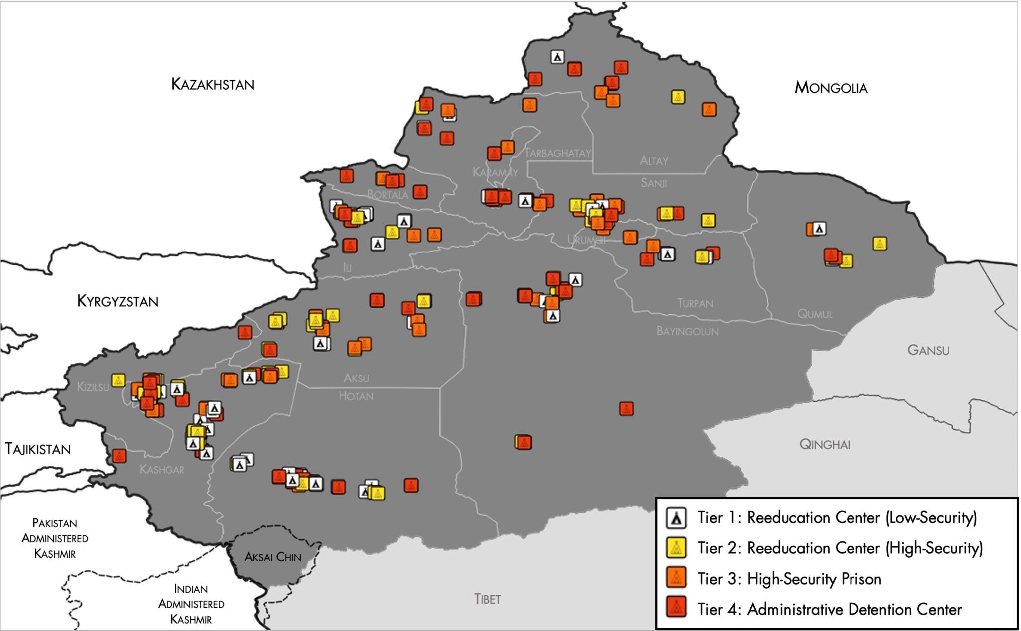
English: Map of the Xinjiang Internment Camps created by the RAND Corporation based on data collected by the US National Geospatial Intelligence Agency and the Australian Strategic Policy Institute. Open source here. |
||||||||
| Päiväys | |||||||||
| Lähde | https://www.tearline.mil/public_page/xinjiang-nighttime-1/ | ||||||||
| Tekijä | National Geospatial Intelligence Agency, using data from the Australian Strategic Policy Institute, and administrative boundaries from GADM. | ||||||||
| Käyttöoikeus (Tämän tiedoston uudelleenkäyttö) |
|


Tiedoston historia
Päiväystä napsauttamalla näet, millainen tiedosto oli kyseisellä hetkellä.
| Päiväys | Pienoiskuva | Koko | Käyttäjä | Kommentti | |
|---|---|---|---|---|---|
| nykyinen | 2. toukokuuta 2021 kello 08.05 | | 2 048 × 1 267 (150 KiB) | Abovfold | Uploaded a work by {{w|National Geospatial Intelligence Agency}}, using data from the {{w|Australian Strategic Policy Institute}}, and administrative boundaries from {{w|GADM}}. from https://www.tearline.mil/public_page/xinjiang-nighttime-1/ with UploadWizard |
Tiedoston käyttö
Seuraava sivu käyttää tätä tiedostoa:
Tiedoston järjestelmänlaajuinen käyttö
Seuraavat muut wikit käyttävät tätä tiedostoa:
- Käyttö kohteessa ba.wikipedia.org
- Käyttö kohteessa br.wikipedia.org
- Käyttö kohteessa cs.wikipedia.org
- Käyttö kohteessa de.wikipedia.org
- Käyttö kohteessa el.wikipedia.org
- Käyttö kohteessa en.wikipedia.org
- Käyttö kohteessa es.wikipedia.org
- Käyttö kohteessa fr.wikipedia.org
- Käyttö kohteessa ga.wikipedia.org
- Käyttö kohteessa he.wikipedia.org
- Käyttö kohteessa km.wikipedia.org
- Käyttö kohteessa nl.wikipedia.org
- Käyttö kohteessa or.wikipedia.org
- Käyttö kohteessa pl.wikipedia.org
- Käyttö kohteessa pt.wikipedia.org
- Käyttö kohteessa ru.wikinews.org
- Käyttö kohteessa sv.wikipedia.org
- Käyttö kohteessa szl.wikipedia.org
- Käyttö kohteessa tr.wikipedia.org
- Käyttö kohteessa www.wikidata.org