Tiedosto:Saldanha Bay WW.jpg
Siirry navigaatioon
Siirry hakuun

Tämän esikatselun koko: 750 × 600 kuvapistettä. Muut resoluutiot: 300 × 240 kuvapistettä | 600 × 480 kuvapistettä | 960 × 768 kuvapistettä | 1 280 × 1 024 kuvapistettä.
Alkuperäinen tiedosto (1 280 × 1 024 kuvapistettä, 933 KiB, MIME-tyyppi: image/jpeg)
| Tämä tiedosto on tiedostotietokanta Wikimedia Commonsista. Tiedot kuvaussivulta näkyvät alla. |  |
Tiedoston kuvaussivu Commonsissa |
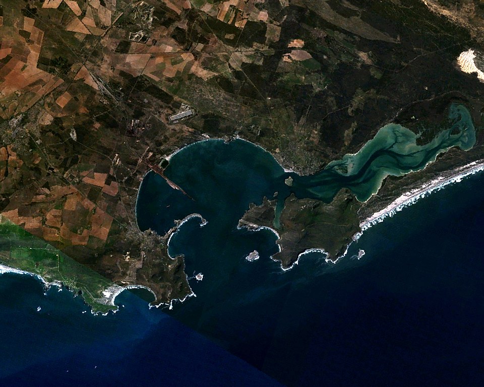
| Kuvaus | Saldanha Bay, Western Cape, South Africa. Coordinates: 33º 02' 11" S 17º 59' 04" E. Facing east (north is to the left.) |
| Päiväys | |
| Lähde | Made with The GIMP! from a NASA World Wind screenshot |
| Tekijä | Júlio Reis (User:Tintazul) |
| Käyttöoikeus (Tämän tiedoston uudelleenkäyttö) |
I, the author release this image into Public Domain. |
| This image is in the public domain because it is a screenshot from NASA’s globe software World Wind using a public domain layer, such as Blue Marble, MODIS, Landsat, SRTM, USGS or GLOBE.
|
 |
Tiedoston historia
Päiväystä napsauttamalla näet, millainen tiedosto oli kyseisellä hetkellä.
| Päiväys | Pienoiskuva | Koko | Käyttäjä | Kommentti | |
|---|---|---|---|---|---|
| nykyinen | 6. marraskuuta 2005 kello 02.33 | | 1 280 × 1 024 (933 KiB) | Tintazul | {{Information| |Description=Saldanha Bay, Western Cape, South Africa. Coordinates: 33º 02' 11" S 17º 59' 04" E. Facing east (north is to the left.) |Source=Made with [http://www.gimp.org/ The GIMP!] from a [http://worldwind.arc.nasa.gov/ NASA World Wind |
Tiedoston käyttö
Seuraava sivu käyttää tätä tiedostoa:
Tiedoston järjestelmänlaajuinen käyttö
Seuraavat muut wikit käyttävät tätä tiedostoa:
- Käyttö kohteessa af.wikipedia.org
- Käyttö kohteessa ceb.wikipedia.org
- Käyttö kohteessa de.wikipedia.org
- Käyttö kohteessa en.wikipedia.org
- Käyttö kohteessa eo.wikipedia.org
- Käyttö kohteessa es.wikipedia.org
- Käyttö kohteessa fr.wikipedia.org
- Käyttö kohteessa it.wikipedia.org
- Käyttö kohteessa nl.wikipedia.org
- Käyttö kohteessa pt.wikipedia.org
- Käyttö kohteessa ru.wikipedia.org
- Käyttö kohteessa www.wikidata.org
- Käyttö kohteessa zh.wikipedia.org