Tiedosto:Romania 1956-1990.svg
Siirry navigaatioon
Siirry hakuun

Tämän PNG-esikatselun koko koskien SVG-tiedostoa: 450 × 456 kuvapistettä. Muut resoluutiot: 237 × 240 kuvapistettä | 474 × 480 kuvapistettä | 758 × 768 kuvapistettä | 1 011 × 1 024 kuvapistettä | 2 021 × 2 048 kuvapistettä.
Alkuperäinen tiedosto (SVG-tiedosto; oletustarkkuus 450 × 456 kuvapistettä; tiedostokoko 475 KiB)
| Tämä tiedosto on tiedostotietokanta Wikimedia Commonsista. Tiedot kuvaussivulta näkyvät alla. |  |
Tiedoston kuvaussivu Commonsissa |
Yhteenveto


.svg)
.svg)
.svg)
.svg)
.svg)


.svg)
.svg)
.svg)


.png)
.png)


.svg)


.svg)

.svg)


.svg)
.svg)
.svg)
.svg)


.svg)
.png)


.svg)


.svg)
.svg)


.svg)


.svg)


.svg)
.svg)
.svg)
.svg)
.svg)
.svg)
.svg)
_cropped.svg)
.svg)
.svg)
.svg)
.svg)
.svg)
.svg)
.svg)
.svg)
.svg)
.svg)
.svg)
.svg)
.svg)
.svg)
.svg)
.svg)
.svg)
.svg)
.svg)
.svg)
.svg)
.svg)
.svg)
.svg)
.svg)
.svg)
.svg)
.svg)
.svg)
.svg)
.svg)
.svg)
.svg)
.svg)
.svg)
.svg)
.svg)
.svg)
.svg)
.svg)
.svg)
.svg)
.svg)
.svg)
.svg)
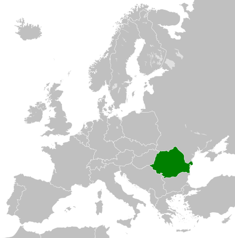
| Tämän kuvan originaalia on jälkikäsitelty digitaalisesti. Originaali: Blank map of Europe 1956-1990.svg.
|
Lisenssi
Minä, tämän teoksen tekijänoikeuksien haltija, julkaisen täten tämän teoksen seuraavalla lisenssillä:
Tämä tiedosto on lisensoitu Creative Commons Nimeä-JaaSamoin 3.0 Ei sovitettu -lisenssillä.
- Voit:
- jakaa – kopioida, levittää ja esittää teosta
- remiksata – valmistaa muutettuja teoksia
- Seuraavilla ehdoilla:
- nimeäminen – Sinun on mainittava lähde asianmukaisesti, tarjottava linkki lisenssiin sekä merkittävä, mikäli olet tehnyt muutoksia. Voit tehdä yllä olevan millä tahansa kohtuullisella tavalla, mutta et siten, että annat ymmärtää lisenssinantajan suosittelevan sinua tai teoksen käyttöäsi.
- jaa samoin – Jos muutat tai perustat tähän työhön, voit jakaa tuloksena syntyvää työtä vain tällä tai tämän kaltaisella lisenssillä.
Alkuperäinen tallennusloki
This image is a derivative work of the following images:
- File:Blank_map_of_Europe_1956-1990.svg licensed with Cc-by-sa-3.0
- 2011-10-30T04:43:42Z Alphathon 450x456 (485146 Bytes) == {{int:filedesc}} == {{Information |Description={{en|Blank map of Europe showing national borders as they stood from 1956-1990.}} |Source=*[[:File:Blank_map_of_Europe.svg|]] |Date=2011-10-30 04:42 (UTC) |Author=*[[:File:Bla
Tiedoston historia
Päiväystä napsauttamalla näet, millainen tiedosto oli kyseisellä hetkellä.
| Päiväys | Pienoiskuva | Koko | Käyttäjä | Kommentti | |
|---|---|---|---|---|---|
| nykyinen | 30. lokakuuta 2023 kello 21.06 | | 450 × 456 (475 KiB) | Rgvis | Ceausescu demanded the cancellation of all agreements concluded during the Second World War with Nazi Germany, but without any modification of the borders: [https://www.mediafax.ro/revolutie-30/revolutions-la-congresul-al-xiv-lea-al-pcr-ceausescu-a-cerut-anularea-pactului-ribbentrop-molotov-partea-a-iii-a-18602951] |
| 2. toukokuuta 2023 kello 20.01 |  | 450 × 456 (480 KiB) | Glide08 | Reverted to version as of 17:25, 30 September 2022 (UTC) for a brief period between the 14 Congress of the PCR and the downfall of Ceausescu's regime, they did. The 14th congress of the PCR passed a resolution that demanded the annulment of the Molotov-Ribbentrop pact (which meant ceding Bessarabia back to Romania) | |
| 1. toukokuuta 2023 kello 21.22 |  | 450 × 456 (475 KiB) | Trecătorul răcit | The areas annexed by USSR (1940) were NOT claimed by the communist Romania during its existence (nor after).. | |
| 30. syyskuuta 2022 kello 20.25 |  | 450 × 456 (480 KiB) | Glide08 | Added a mark for Bessarabia dn Northern Bukovina, claimed by Romania between the 14th Congress of the PCR and the Revolution | |
| 26. marraskuuta 2011 kello 03.46 |  | 450 × 456 (475 KiB) | StalwartUK | == {{int:filedesc}} == {{Information |Description={{en|Map of Communist Romania (Romanian People's Republic/Socialist Republic of Romania) as it was from 1947-1989. Surrounding countries accurate from 1956-1990.}} |Source=*[[:Fil |
Tiedoston käyttö
Seuraava sivu käyttää tätä tiedostoa:
Tiedoston järjestelmänlaajuinen käyttö
Seuraavat muut wikit käyttävät tätä tiedostoa:
- Käyttö kohteessa als.wikipedia.org
- Käyttö kohteessa ast.wikipedia.org
- Käyttö kohteessa azb.wikipedia.org
- Käyttö kohteessa az.wikipedia.org
- Käyttö kohteessa be.wikipedia.org
- Käyttö kohteessa bg.wikipedia.org
- Käyttö kohteessa bn.wikipedia.org
- Käyttö kohteessa ca.wikipedia.org
- Käyttö kohteessa cs.wikipedia.org
- Käyttö kohteessa cs.wikiquote.org
- Käyttö kohteessa de.wikipedia.org
- Käyttö kohteessa en.wikipedia.org
- Käyttö kohteessa en.wikiquote.org
- Käyttö kohteessa eo.wikipedia.org
- Käyttö kohteessa es.wikipedia.org
- Käyttö kohteessa et.wikipedia.org
- Käyttö kohteessa fa.wikipedia.org
- Käyttö kohteessa fr.wikipedia.org
- Käyttö kohteessa gl.wikipedia.org
- Käyttö kohteessa he.wikipedia.org
- Käyttö kohteessa id.wikipedia.org
- Käyttö kohteessa it.wikipedia.org
- Käyttö kohteessa ja.wikipedia.org
- Käyttö kohteessa ko.wikipedia.org
- Käyttö kohteessa lt.wikipedia.org
- Käyttö kohteessa lv.wikipedia.org
- Käyttö kohteessa nl.wikipedia.org
- Käyttö kohteessa os.wikipedia.org
- Käyttö kohteessa pnb.wikipedia.org
- Käyttö kohteessa pt.wikipedia.org
- Käyttö kohteessa ro.wikipedia.org
- Käyttö kohteessa rue.wikipedia.org
- Käyttö kohteessa ru.wikipedia.org
- Käyttö kohteessa sc.wikipedia.org
- Käyttö kohteessa simple.wikipedia.org
- Käyttö kohteessa sk.wikipedia.org
- Käyttö kohteessa sq.wikipedia.org
- Käyttö kohteessa sr.wikipedia.org
Näytä lisää tämän tiedoston järjestelmänlaajuista käyttöä.