Tiedosto:INHP NPS map.svg
Siirry navigaatioon
Siirry hakuun

Tämän PNG-esikatselun koko koskien SVG-tiedostoa: 717 × 599 kuvapistettä. Muut resoluutiot: 287 × 240 kuvapistettä | 574 × 480 kuvapistettä | 919 × 768 kuvapistettä | 1 225 × 1 024 kuvapistettä | 2 450 × 2 048 kuvapistettä | 1 511 × 1 263 kuvapistettä.
Alkuperäinen tiedosto (SVG-tiedosto; oletustarkkuus 1 511 × 1 263 kuvapistettä; tiedostokoko 880 KiB)
| Tämä tiedosto on tiedostotietokanta Wikimedia Commonsista. Tiedot kuvaussivulta näkyvät alla. |  |
Tiedoston kuvaussivu Commonsissa |
Yhteenveto
| Kuvaus |
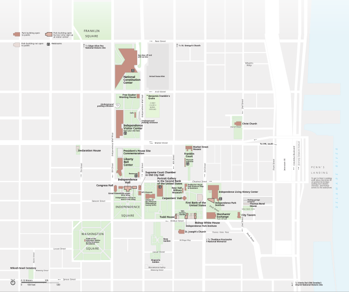
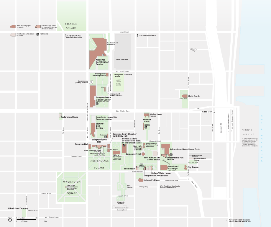
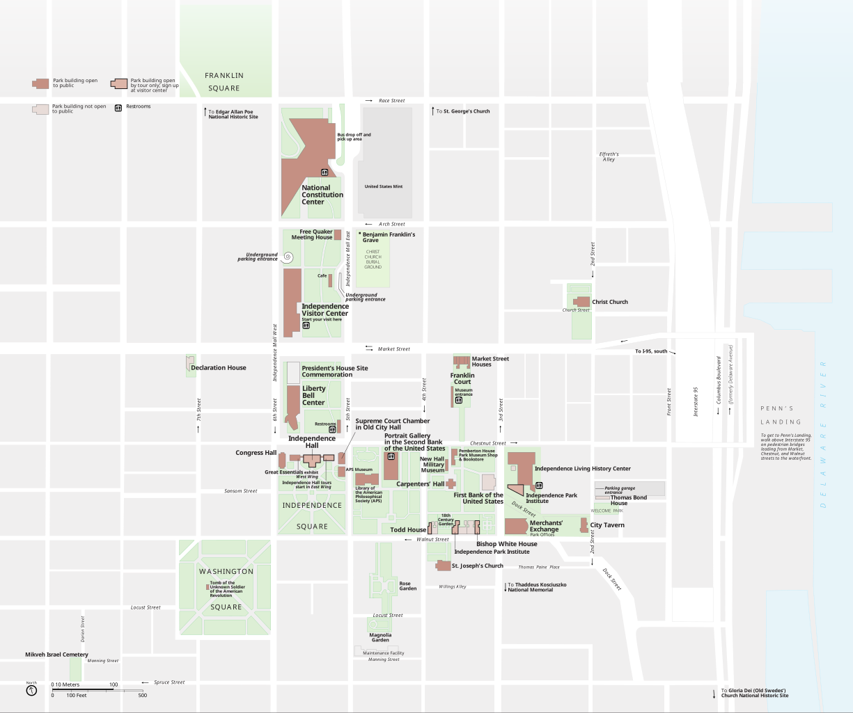
English: Map of Independence National Historical Park in Philadelphia created by the National Park Service. Original version. |
| Päiväys | |
| Lähde | National Park Service |
| Tekijä | Harpers Ferry Center |
Lisenssi
| This image or media file contains material based on a work of a National Park Service employee, created as part of that person's official duties. As a work of the U.S. federal government, such work is in the public domain in the United States. See the NPS website and NPS copyright policy for more information. |
Tiedoston historia
Päiväystä napsauttamalla näet, millainen tiedosto oli kyseisellä hetkellä.
| Päiväys | Pienoiskuva | Koko | Käyttäjä | Kommentti | |
|---|---|---|---|---|---|
| nykyinen | 28. toukokuuta 2011 kello 22.54 | | 1 511 × 1 263 (880 KiB) | Apollo1758 |
Tiedoston käyttö
Seuraava sivu käyttää tätä tiedostoa: