Tiedosto:BlankMap-USA-states-Canada-provinces, HI closer.svg
Siirry navigaatioon
Siirry hakuun

Tämän PNG-esikatselun koko koskien SVG-tiedostoa: 512 × 512 kuvapistettä. Muut resoluutiot: 240 × 240 kuvapistettä | 480 × 480 kuvapistettä | 768 × 768 kuvapistettä | 1 024 × 1 024 kuvapistettä | 2 048 × 2 048 kuvapistettä.
Alkuperäinen tiedosto (SVG-tiedosto; oletustarkkuus 512 × 512 kuvapistettä; tiedostokoko 104 KiB)
| Tämä tiedosto on tiedostotietokanta Wikimedia Commonsista. Tiedot kuvaussivulta näkyvät alla. |  |
Tiedoston kuvaussivu Commonsissa |
| Kuvaus |
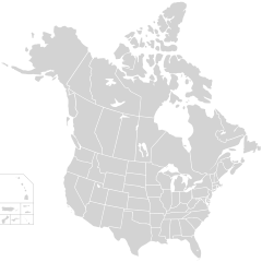
English: Blank SVG map of USA and Canada with state and province borders. Hawaii has been moved closer to the mainland USA to reduce width of image.
Non-contiguous parts of a states/provinces are "grouped" together with the main area of the state/provinces, so any state/provinces can be coloured in completion with one click anywhere on the state/provinces's area. Also, all states/provinces have a "id" attached to them, making them easy to find. Select "find" and then enter in the state/provinces's ISO 3166-2 code in the "id" field to find it. The codes can be found here (Canada) and here (USA). |
| Päiväys | |
| Lähde |
|
| Tekijä | Lokal_Profil |
| Käyttöoikeus (Tämän tiedoston uudelleenkäyttö) |
Tämä tiedosto on lisensoitu Creative Commons Nimeä-JaaSamoin 2.5 Yleinen -lisenssillä. Nimeä: Lokal_Profil
|
| Muut versiot |
This vector image includes elements that have been taken or adapted from this file:
The same as this map with the two-letter state or province name label for each one |
Tiedoston historia
Päiväystä napsauttamalla näet, millainen tiedosto oli kyseisellä hetkellä.
| Päiväys | Pienoiskuva | Koko | Käyttäjä | Kommentti | |
|---|---|---|---|---|---|
| nykyinen | 23. marraskuuta 2020 kello 04.48 | | 512 × 512 (104 KiB) | Ponderosapine210 | Accidentally uploaded wrong version. Here is the correct one. |
| 23. marraskuuta 2020 kello 04.38 |  | 512 × 596 (132 KiB) | Ponderosapine210 | Added the prominent islands of Manitoulin (Ontario) and Isle Royale (Michigan) to the Great Lakes. | |
| 2. kesäkuuta 2019 kello 01.59 |  | 512 × 512 (99 KiB) | Fluffy89502 | added territories | |
| 9. joulukuuta 2007 kello 00.18 |  | 1 730 × 1 730 (212 KiB) | Lokal Profil | Code trimming | |
| 3. heinäkuuta 2007 kello 07.21 |  | 1 730 × 1 730 (213 KiB) | Lokal Profil | {{Information |Description={{en|Blank SVG map of USA and Canada with state and province borders. Hawaii has been moved closer to the mainland USA to reduce width of image.}} Non-contiguous parts of a states/provinces are "grouped" together with the main a |
Tiedoston käyttö
Tätä tiedostoa ei käytetä millään sivulla.
Tiedoston järjestelmänlaajuinen käyttö
Seuraavat muut wikit käyttävät tätä tiedostoa:
- Käyttö kohteessa en.wikipedia.org
- Käyttö kohteessa fr.wikipedia.org