Tiedosto:NATO and the Warsaw Pact 1973.svg
Siirry navigaatioon
Siirry hakuun

Tämän PNG-esikatselun koko koskien SVG-tiedostoa: 450 × 456 kuvapistettä. Muut resoluutiot: 237 × 240 kuvapistettä | 474 × 480 kuvapistettä | 758 × 768 kuvapistettä | 1 011 × 1 024 kuvapistettä | 2 021 × 2 048 kuvapistettä.
Alkuperäinen tiedosto (SVG-tiedosto; oletustarkkuus 450 × 456 kuvapistettä; tiedostokoko 478 KiB)
| Tämä tiedosto on tiedostotietokanta Wikimedia Commonsista. Tiedot kuvaussivulta näkyvät alla. |  |
Tiedoston kuvaussivu Commonsissa |
Yhteenveto


.svg)
.svg)
.svg)
.svg)
.svg)


.svg)
.svg)
.svg)


.png)
.png)


.svg)


.svg)

.svg)


.svg)
.svg)
.svg)
.svg)


.svg)
.png)


.svg)


.svg)
.svg)


.svg)


.svg)


.svg)
.svg)
.svg)
.svg)
.svg)
.svg)
.svg)
_cropped.svg)
.svg)
.svg)
.svg)
.svg)
.svg)
.svg)
.svg)
.svg)
.svg)
.svg)
.svg)
.svg)
.svg)
.svg)
.svg)
.svg)
.svg)
.svg)
.svg)
.svg)
.svg)
.svg)
.svg)
.svg)
.svg)
.svg)
.svg)
.svg)
.svg)
.svg)
.svg)
.svg)
.svg)
.svg)
.svg)
.svg)
.svg)
.svg)
.svg)
.svg)
.svg)
.svg)
.svg)
.svg)
.svg)
Lisenssi
Minä, tämän teoksen tekijänoikeuksien haltija, julkaisen täten tämän teoksen seuraavalla lisenssillä:
Tämä tiedosto on lisensoitu Creative Commons Nimeä-JaaSamoin 3.0 Ei sovitettu -lisenssillä.
- Voit:
- jakaa – kopioida, levittää ja esittää teosta
- remiksata – valmistaa muutettuja teoksia
- Seuraavilla ehdoilla:
- nimeäminen – Sinun on mainittava lähde asianmukaisesti, tarjottava linkki lisenssiin sekä merkittävä, mikäli olet tehnyt muutoksia. Voit tehdä yllä olevan millä tahansa kohtuullisella tavalla, mutta et siten, että annat ymmärtää lisenssinantajan suosittelevan sinua tai teoksen käyttöäsi.
- jaa samoin – Jos muutat tai perustat tähän työhön, voit jakaa tuloksena syntyvää työtä vain tällä tai tämän kaltaisella lisenssillä.
Alkuperäinen tallennusloki
This image is a derivative work of the following images:
- File:Blank_map_of_Europe_1956-1990.svg licensed with Cc-by-sa-3.0
- 2011-10-30T04:43:42Z Alphathon 450x456 (485146 Bytes) == {{int:filedesc}} == {{Information |Description={{en|Blank map of Europe showing national borders as they stood from 1956-1990.}} |Source=*[[:File:Blank_map_of_Europe.svg|]] |Date=2011-10-30 04:42 (UTC) |Author=*[[:File:Bla
Uploaded with derivativeFX
Tiedoston historia
Päiväystä napsauttamalla näet, millainen tiedosto oli kyseisellä hetkellä.
| Päiväys | Pienoiskuva | Koko | Käyttäjä | Kommentti | |
|---|---|---|---|---|---|
| nykyinen | 22. heinäkuuta 2022 kello 12.17 | | 450 × 456 (478 KiB) | Kwamikagami | change to NATO blue; Liecht. not a member |
| 30. kesäkuuta 2016 kello 09.43 |  | 450 × 456 (477 KiB) | FreshCorp619 | Reverted to version as of 18:32, 25 February 2012 (UTC) | |
| 30. kesäkuuta 2016 kello 09.42 |  | 450 × 456 (728 KiB) | FreshCorp619 | fixed errors | |
| 30. kesäkuuta 2016 kello 09.38 |  | 450 × 456 (707 KiB) | FreshCorp619 | Added Byelorussian and Ukrainian SSRs (UN Members) | |
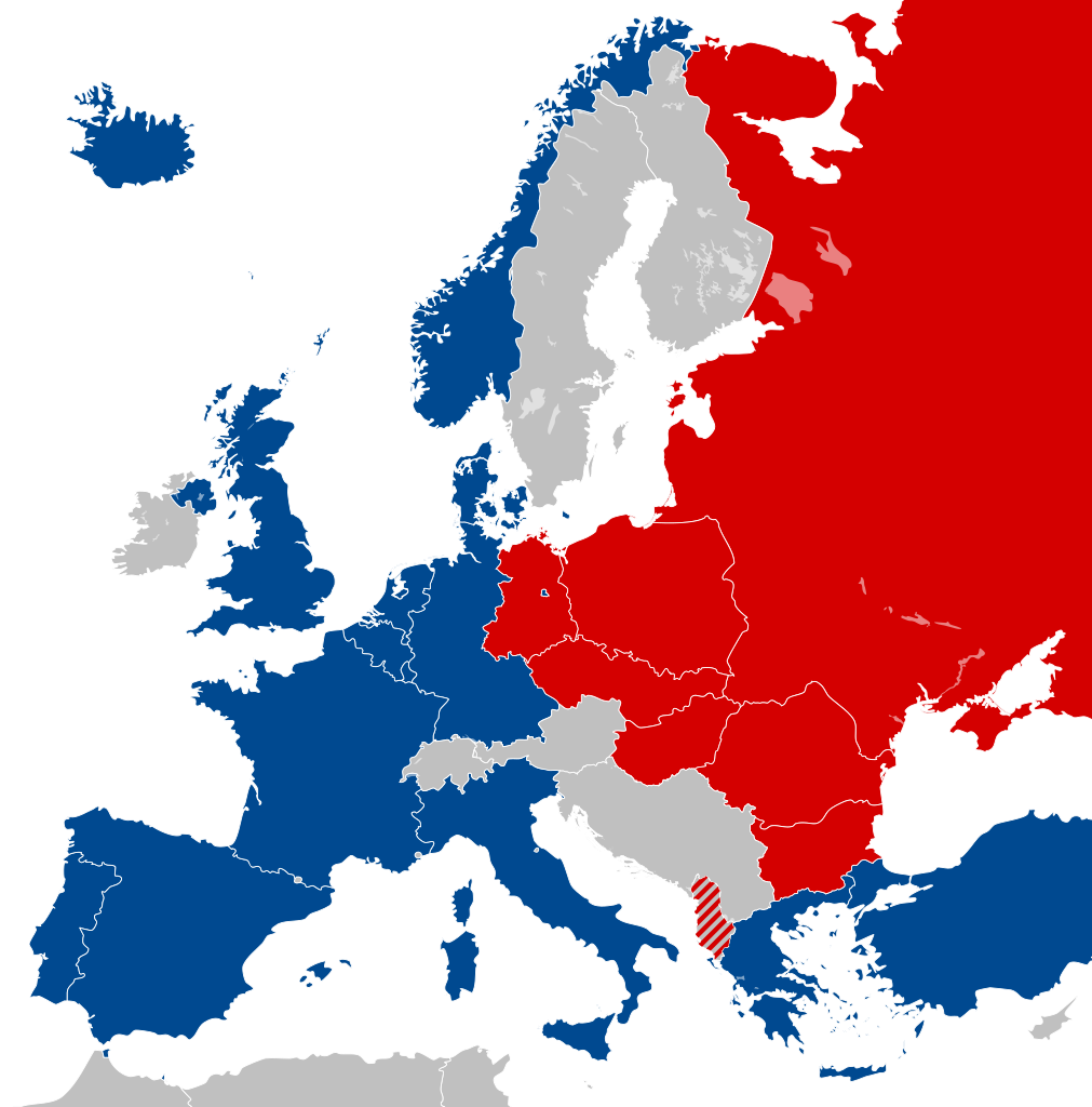
| 25. helmikuuta 2012 kello 21.32 |  | 450 × 456 (477 KiB) | Alphathon | == {{int:filedesc}} == {{Information |Description={{en|Map of Europe showing NATO and the Warsaw Pact circa 1973.}} |Source={{Derived from|Blank_map_of_Europe_1956-1990.svg|display=50}} |Date=2012-02-25 18:31 (UTC) |Aut... |
Tiedoston käyttö
Seuraava sivu käyttää tätä tiedostoa:
Tiedoston järjestelmänlaajuinen käyttö
Seuraavat muut wikit käyttävät tätä tiedostoa:
- Käyttö kohteessa als.wikipedia.org
- Käyttö kohteessa ar.wikipedia.org
- Käyttö kohteessa ca.wikipedia.org
- Unió de Repúbliques Socialistes Soviètiques
- República Democràtica Alemanya
- República Socialista Federativa Soviètica de Rússia
- República Federal Socialista de Iugoslàvia
- Pacte de Varsòvia
- Consell d'Assistència Econòmica Mútua
- Bloc de l'Est
- República Popular d'Albània
- República Socialista de Romania
- República Democràtica de Finlàndia
- Història de la Unió Soviètica (1985-1991)
- Història de la Unió Soviètica (1953-1985)
- República Popular de Polònia
- Plantilla:Europa Oriental Comunista
- Història de la Unió Soviètica i la Rússia Soviètica (1917-1927)
- Economia de la Unió Soviètica
- Doctrina Bréjnev
- República Popular d'Hongria
- República Popular de Bulgària
- República Socialista Txecoslovaca
- Ampliació de la Unió Europea de 2004
- Käyttö kohteessa de.wikipedia.org
- Käyttö kohteessa el.wikipedia.org
- Käyttö kohteessa en.wikipedia.org
- History of the Soviet Union (1982–1991)
- East Germany
- Warsaw Pact
- History of Soviet Russia and the Soviet Union (1917–1927)
- Byelorussian Soviet Socialist Republic
- History of the Soviet Union (1953–1964)
- Socialist Republic of Romania
- Democratic Federal Yugoslavia
- Socialist Federal Republic of Yugoslavia
- Polish People's Republic
- Ukrainian Soviet Socialist Republic
- History of Czechoslovakia (1948–1989)
- History of the Soviet Union (1927–1953)
- History of Poland (1945–1989)
- Czechoslovak Socialist Republic
- Template:Communist Eastern and Central Europe
- People's Republic of Bulgaria
- Hungarian People's Republic
- History of East Germany
- People's Socialist Republic of Albania
- History of the Soviet Union (1964–1982)
- User:Peterstrempel/Soviet-Brezhnev-draft
- History of the Soviet Union
- History of NATO
- User:Y-S.Ko/Wikipedia course/History
Näytä lisää tämän tiedoston järjestelmänlaajuista käyttöä.