Tiedosto:King-George-Island-location-map.png
Siirry navigaatioon
Siirry hakuun
Tämän esikatselun koko: 800 × 548 kuvapistettä. Muut resoluutiot: 320 × 219 kuvapistettä | 640 × 439 kuvapistettä | 1 024 × 702 kuvapistettä | 1 280 × 877 kuvapistettä | 1 669 × 1 144 kuvapistettä.
Alkuperäinen tiedosto (1 669 × 1 144 kuvapistettä, 150 KiB, MIME-tyyppi: image/png)
| Tämä tiedosto on tiedostotietokanta Wikimedia Commonsista. Tiedot kuvaussivulta näkyvät alla. |  |
Tiedoston kuvaussivu Commonsissa |
Yhteenveto
| Kuvaus |
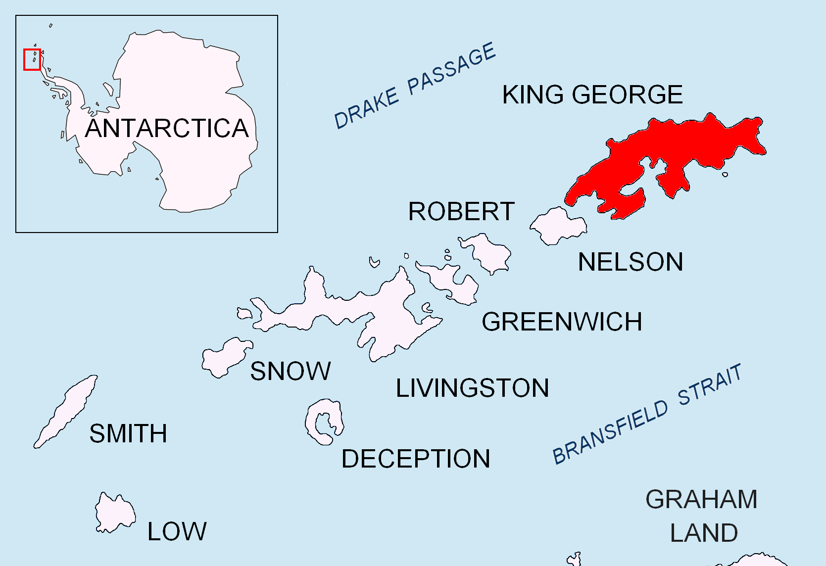
English: Location map of King George Island in the South Shetland Islands. |
| Päiväys | |
| Lähde | Oma teos |
| Tekijä | Apcbg |
Lisenssi
Minä, tämän teoksen tekijänoikeuksien haltija, julkaisen täten tämän teoksen seuraavilla lisensseillä:
Tämä tiedosto on lisensoitu Creative Commons Nimeä-JaaSamoin 3.0 Ei sovitettu -lisenssillä.
- Voit:
- jakaa – kopioida, levittää ja esittää teosta
- remiksata – valmistaa muutettuja teoksia
- Seuraavilla ehdoilla:
- nimeäminen – Sinun on mainittava lähde asianmukaisesti, tarjottava linkki lisenssiin sekä merkittävä, mikäli olet tehnyt muutoksia. Voit tehdä yllä olevan millä tahansa kohtuullisella tavalla, mutta et siten, että annat ymmärtää lisenssinantajan suosittelevan sinua tai teoksen käyttöäsi.
- jaa samoin – Jos muutat tai perustat tähän työhön, voit jakaa tuloksena syntyvää työtä vain tällä tai tämän kaltaisella lisenssillä.

|
Voit kopioida, levittää ja/tai muuttaa tätä asiakirjaa GNU Free Documentation License -lisenssin version 1.2 tai minkä tahansa Free Software Foundationin julkaiseman myöhemmän version ehtojen alaisena; ei koske muuttumattomia kohtia, etukannen tekstejä eikä takakannen tekstejä. Kopio tästä lisenssistä on saatavilla osiossa GNU Free Documentation License. |
Voit valita haluamasi lisenssin.
Tiedoston historia
Päiväystä napsauttamalla näet, millainen tiedosto oli kyseisellä hetkellä.
| Päiväys | Pienoiskuva | Koko | Käyttäjä | Kommentti | |
|---|---|---|---|---|---|
| nykyinen | 24. elokuuta 2010 kello 20.27 | | 1 669 × 1 144 (150 KiB) | Apcbg | + location in Antarctica |
| 27. huhtikuuta 2010 kello 21.57 |  | 1 669 × 1 144 (5,47 MiB) | Apcbg | {{Information |Description={{en|1=Location map of King George Island in the South Shetland Islands.}} |Source={{own}} |Author=Apcbg |Date=2010-04-27 |Permission= |other_versions= }} Category:Maps of Antarctica |
Tiedoston käyttö
Seuraava sivu käyttää tätä tiedostoa:
Tiedoston järjestelmänlaajuinen käyttö
Seuraavat muut wikit käyttävät tätä tiedostoa:
- Käyttö kohteessa ar.wikipedia.org
- Käyttö kohteessa az.wikipedia.org
- Käyttö kohteessa bg.wikipedia.org
- Käyttö kohteessa en.wikipedia.org
- Henryk Arctowski Polish Antarctic Station
- Bellingshausen Station
- Artigas Base
- Shearer Stack
- Sherratt Bay
- Syrezol Rocks
- Chabrier Rock
- Telefon Rocks
- Simpson Rocks
- Caraquet Rock
- Upton Rock
- Ørnen Rocks
- Nancy Rock
- Napier Rock
- Growler Rock
- Tu Rocks
- Dufayel Island
- Emm Rock
- Low Rock
- Livonia Rock
- Hauken Rock
- Martello Tower (South Shetland Islands)
- Twin Pinnacles
- Sinbad Rock
- Hole Rock
- Vauréal Peak
- Limit Rock
- Käyttö kohteessa es.wikipedia.org
- Käyttö kohteessa ko.wikipedia.org
- Käyttö kohteessa mk.wikipedia.org
- Käyttö kohteessa nl.wikipedia.org
- Käyttö kohteessa nn.wikipedia.org
- Käyttö kohteessa pt.wikipedia.org
- Käyttö kohteessa ta.wikipedia.org
- Käyttö kohteessa zh.wikipedia.org
Näytä lisää tämän tiedoston järjestelmänlaajuista käyttöä.