Tiedosto:Karte Lueneburg in Deutschland.png
Siirry navigaatioon
Siirry hakuun
Tarkempaa kuvaa ei ole saatavilla.
Karte_Lueneburg_in_Deutschland.png (188 × 235 kuvapistettä, 5 KiB, MIME-tyyppi: image/png)
| Tämä tiedosto on tiedostotietokanta Wikimedia Commonsista. Tiedot kuvaussivulta näkyvät alla. |  |
Tiedoston kuvaussivu Commonsissa |
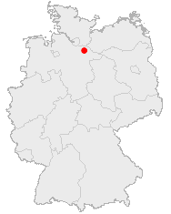
This image was generated with OpenGeoDB. The information there is placed in the public domain, images generated from OpenGeoDB are derivative works without passing the threshold of creativity, they are therefore also public domain.
| Tämä tiedosto ei ylitä teoskynnystä, joten se ei saa tekijänoikeuden suojaa. |
Tiedoston historia
Päiväystä napsauttamalla näet, millainen tiedosto oli kyseisellä hetkellä.
| Päiväys | Pienoiskuva | Koko | Käyttäjä | Kommentti | |
|---|---|---|---|---|---|
| nykyinen | 8. lokakuuta 2005 kello 17.43 | | 188 × 235 (5 KiB) | Schieber | *'''Description:''' {{GFDL-OpenGeoDB}} {{GFDL}} Category:Lüneburg, Germany |
Tiedoston käyttö
Tätä tiedostoa ei käytetä millään sivulla.
Tiedoston järjestelmänlaajuinen käyttö
Seuraavat muut wikit käyttävät tätä tiedostoa:
- Käyttö kohteessa de.wikinews.org
- Käyttö kohteessa es.wikipedia.org
- Käyttö kohteessa ja.wikipedia.org
- Käyttö kohteessa pl.wikivoyage.org
- Käyttö kohteessa sq.wikipedia.org