Tiedosto:Ireland location map.svg
Siirry navigaatioon
Siirry hakuun

Tämän PNG-esikatselun koko koskien SVG-tiedostoa: 481 × 599 kuvapistettä. Muut resoluutiot: 192 × 240 kuvapistettä | 385 × 480 kuvapistettä | 616 × 768 kuvapistettä | 822 × 1 024 kuvapistettä | 1 643 × 2 048 kuvapistettä | 1 450 × 1 807 kuvapistettä.
Alkuperäinen tiedosto (SVG-tiedosto; oletustarkkuus 1 450 × 1 807 kuvapistettä; tiedostokoko 938 KiB)
| Tämä tiedosto on tiedostotietokanta Wikimedia Commonsista. Tiedot kuvaussivulta näkyvät alla. |  |
Tiedoston kuvaussivu Commonsissa |
Yhteenveto
| Kuvaus |
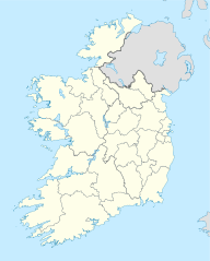
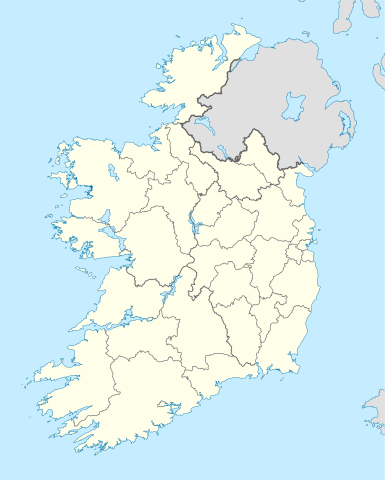
Deutsch: Positionskarte von Irland
Quadratische Plattkarte, N-S-Streckung 170 %. Geographische Begrenzung der Karte:
English: Location map of Ireland
Equirectangular projection, N/S stretching 170 %. Geographic limits of the map:
|
| Päiväys | 01-07-2008 |
| Lähde | own work, using United States National Imagery and Mapping Agency data |
| Tekijä | NordNordWest |
| Muut versiot |
DerivativeVersions |


|
Saksankielisen Wikipedian projekti Kartenwerkstatt on parantanut tätä karttaa. Myös sinä voit ehdottaa jotakin karttaa parannettavaksi.
|
Lisenssi
Minä, tämän teoksen tekijänoikeuksien haltija, julkaisen täten tämän teoksen seuraavilla lisensseillä:

|
Voit kopioida, levittää ja/tai muuttaa tätä asiakirjaa GNU Free Documentation License -lisenssin version 1.2 tai minkä tahansa Free Software Foundationin julkaiseman myöhemmän version ehtojen alaisena; ei koske muuttumattomia kohtia, etukannen tekstejä eikä takakannen tekstejä. Kopio tästä lisenssistä on saatavilla osiossa GNU Free Documentation License. |
Tämä tiedosto on lisensoitu Creative Commons Nimeä-JaaSamoin 3.0 Ei sovitettu -lisenssillä.
- Voit:
- jakaa – kopioida, levittää ja esittää teosta
- remiksata – valmistaa muutettuja teoksia
- Seuraavilla ehdoilla:
- nimeäminen – Sinun on mainittava lähde asianmukaisesti, tarjottava linkki lisenssiin sekä merkittävä, mikäli olet tehnyt muutoksia. Voit tehdä yllä olevan millä tahansa kohtuullisella tavalla, mutta et siten, että annat ymmärtää lisenssinantajan suosittelevan sinua tai teoksen käyttöäsi.
- jaa samoin – Jos muutat tai perustat tähän työhön, voit jakaa tuloksena syntyvää työtä vain tällä tai tämän kaltaisella lisenssillä.
Voit valita haluamasi lisenssin.
Tiedoston historia
Päiväystä napsauttamalla näet, millainen tiedosto oli kyseisellä hetkellä.
| Päiväys | Pienoiskuva | Koko | Käyttäjä | Kommentti | |
|---|---|---|---|---|---|
| nykyinen | 18. heinäkuuta 2020 kello 09.45 | | 1 450 × 1 807 (938 KiB) | Chipmunkdavis | Adding toggle to display pre-2014 boundaries, adjusting some code for names and shape |
| 11. heinäkuuta 2020 kello 09.47 |  | 1 450 × 1 807 (908 KiB) | Chipmunkdavis | Overhauling code, together with code from File:Galway City in Ireland.svg (itself derived from this file), to be both simpler and more easily editable. All islands are now grouped with their mainland county, and counties are grouped into provinces. Groups exist for traditional counties where divided. | |
| 12. syyskuuta 2014 kello 15.08 |  | 1 450 × 1 807 (597 KiB) | Ravenpuff | Retry that | |
| 12. syyskuuta 2014 kello 14.57 |  | 1 450 × 1 807 (597 KiB) | Ravenpuff | Merged North Tipperary and South Tiperrary, Limerick and County Limerick, Waterford and County Waterford (Local Government Reform Act 2014) | |
| 1. syyskuuta 2009 kello 21.04 |  | 1 450 × 1 807 (598 KiB) | NordNordWest | ||
| 25. elokuuta 2008 kello 22.08 |  | 1 450 × 1 807 (599 KiB) | NordNordWest | size correction | |
| 19. heinäkuuta 2008 kello 21.13 |  | 483 × 602 (581 KiB) | NordNordWest | ||
| 1. heinäkuuta 2008 kello 17.13 |  | 483 × 602 (554 KiB) | NordNordWest | {{Information |Description= {{de|Positionskarte von Irland}} Quadratische Plattkarte, N-S-Streckung 170 %. Geographische Begrenzung der Karte: * N: 55.6° N * S: 51.2° N * W: 11.0° W * O: 5.0° W {{en|Location map of [[:en:Ireland|Ireland |
Tiedoston käyttö
Seuraavat 42 sivua käyttävät tätä tiedostoa:
- Arklow
- Bend of the Boyne
- Birr (kaupunki)
- Blackrock
- Bray
- Carrowmore
- Cavan
- Cork
- Dalkey
- Dingle
- Donegal
- Dowth
- Drogheda
- Dublin
- Dundalk
- Dún Aonghasa
- Dún Laoghaire
- Galway
- Gaoth Dobhair
- Howth
- Killarney
- Knowth
- Limerick
- Malahide
- Mallow
- Mayo (Irlanti)
- Millstreet
- Monaghan
- Muckanaghederdauhaulia
- Newgrangen käytävähauta
- Portmarnock
- Shankill (Dublin)
- Shannon (Irlannin kaupunki)
- Shillelagh
- Skerries
- Sligo
- Tipperary
- Tullamore
- Turoen kivi
- Waterford
- Waterville (Kerryn kreivikunta)
- Malline:Sijaintikartta Irlanti
Tiedoston järjestelmänlaajuinen käyttö
Seuraavat muut wikit käyttävät tätä tiedostoa:
- Käyttö kohteessa af.wikipedia.org
- Käyttö kohteessa am.wikipedia.org
- Käyttö kohteessa ar.wikipedia.org
- Käyttö kohteessa arz.wikipedia.org
- Käyttö kohteessa ba.wikipedia.org
- Käyttö kohteessa be-tarask.wikipedia.org
- Käyttö kohteessa be.wikipedia.org
- Käyttö kohteessa bg.wikipedia.org
Näytä lisää tämän tiedoston järjestelmänlaajuista käyttöä.