Tiedosto:Great Britain 1789.svg
Siirry navigaatioon
Siirry hakuun

Tämän PNG-esikatselun koko koskien SVG-tiedostoa: 450 × 456 kuvapistettä. Muut resoluutiot: 237 × 240 kuvapistettä | 474 × 480 kuvapistettä | 758 × 768 kuvapistettä | 1 011 × 1 024 kuvapistettä | 2 021 × 2 048 kuvapistettä.
Alkuperäinen tiedosto (SVG-tiedosto; oletustarkkuus 450 × 456 kuvapistettä; tiedostokoko 848 KiB)
| Tämä tiedosto on tiedostotietokanta Wikimedia Commonsista. Tiedot kuvaussivulta näkyvät alla. |  |
Tiedoston kuvaussivu Commonsissa |
Yhteenveto


.svg)
.svg)
.svg)
.svg)
.svg)


.svg)
.svg)
.svg)


.png)
.png)


.svg)


.svg)

.svg)


.svg)
.svg)
.svg)
.svg)


.svg)
.png)


.svg)


.svg)
.svg)


.svg)


.svg)


.svg)
.svg)
.svg)
.svg)
.svg)
.svg)
.svg)
_cropped.svg)
.svg)
.svg)
.svg)
.svg)
.svg)
.svg)
.svg)
.svg)
.svg)
.svg)
.svg)
.svg)
.svg)
.svg)
.svg)
.svg)
.svg)
.svg)
.svg)
.svg)
.svg)
.svg)
.svg)
.svg)
.svg)
.svg)
.svg)
.svg)
.svg)
.svg)
.svg)
.svg)
.svg)
.svg)
.svg)
.svg)
.svg)
.svg)
.svg)
.svg)
.svg)
.svg)
.svg)
.svg)
.svg)
Lisenssi
Minä, tämän teoksen tekijänoikeuksien haltija, julkaisen täten tämän teoksen seuraavalla lisenssillä:
Tämä tiedosto on lisensoitu Creative Commons Nimeä-JaaSamoin 3.0 Ei sovitettu -lisenssillä.
- Voit:
- jakaa – kopioida, levittää ja esittää teosta
- remiksata – valmistaa muutettuja teoksia
- Seuraavilla ehdoilla:
- nimeäminen – Sinun on mainittava lähde asianmukaisesti, tarjottava linkki lisenssiin sekä merkittävä, mikäli olet tehnyt muutoksia. Voit tehdä yllä olevan millä tahansa kohtuullisella tavalla, mutta et siten, että annat ymmärtää lisenssinantajan suosittelevan sinua tai teoksen käyttöäsi.
- jaa samoin – Jos muutat tai perustat tähän työhön, voit jakaa tuloksena syntyvää työtä vain tällä tai tämän kaltaisella lisenssillä.
Alkuperäinen tallennusloki
This image is a derivative work of the following images:
- File:Europe_1789.svg licensed with Cc-by-sa-3.0
- 2013-04-14T03:44:26Z Alphathon 450x456 (858577 Bytes) Corrected some errors in northern Italy
- 2013-04-14T01:38:01Z Alphathon 450x456 (853881 Bytes) tweaked again
- 2013-04-14T01:36:10Z Alphathon 450x456 (853881 Bytes) Tweaked Holy Roman Empire border style
- 2013-04-14T01:33:26Z Alphathon 450x456 (853857 Bytes) == {{int:filedesc}} == {{Information |Description={{en|A blank Map of Europe circa 1789. This map also includes a border for the [[:en:Holy Roman Empire|Holy Roman Empire]]. Since there are so many small German states, they h
Uploaded with derivativeFX
Tiedoston historia
Päiväystä napsauttamalla näet, millainen tiedosto oli kyseisellä hetkellä.
| Päiväys | Pienoiskuva | Koko | Käyttäjä | Kommentti | |
|---|---|---|---|---|---|
| nykyinen | 19. joulukuuta 2023 kello 19.42 | | 450 × 456 (848 KiB) | Iktsokh | Cyprus paler grey |
| 26. toukokuuta 2022 kello 14.17 |  | 450 × 456 (846 KiB) | Cyygma | Changing pale green to light green (more visible) | |
| 17. lokakuuta 2021 kello 11.08 |  | 450 × 456 (846 KiB) | Fenn-O-maniC | Fixed the Russo-Swedish border to match the Treaty of Åbo of 1743 | |
| 5. syyskuuta 2017 kello 19.20 |  | 450 × 456 (857 KiB) | Alphathon | Danzig | |
| 5. syyskuuta 2017 kello 18.55 |  | 450 × 456 (840 KiB) | Alphathon | Added Brunswick-Lüneburg to British domains as it was rules in a personal union | |
| 5. syyskuuta 2017 kello 18.45 |  | 450 × 456 (840 KiB) | Alphathon | Made Asia paler grey | |
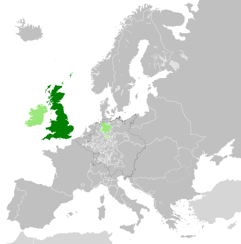
| 5. syyskuuta 2017 kello 18.34 |  | 450 × 456 (840 KiB) | Alphathon | == {{int:filedesc}} == {{Information |Description={{en|A map of the en:Kingdom of Great Britain circa 1789. Other British-held territories (Ireland, Mann, Channel Islands) are also shown in pale green.}}{{de|Eine Karte des [[:de:Königreich Groß... |
Tiedoston käyttö
Seuraava sivu käyttää tätä tiedostoa:
Tiedoston järjestelmänlaajuinen käyttö
Seuraavat muut wikit käyttävät tätä tiedostoa:
- Käyttö kohteessa azb.wikipedia.org
- Käyttö kohteessa bn.wikipedia.org
- Käyttö kohteessa cs.wikipedia.org
- Käyttö kohteessa da.wikipedia.org
- Käyttö kohteessa de.wikipedia.org
- Käyttö kohteessa el.wikipedia.org
- Käyttö kohteessa en.wikipedia.org
- Käyttö kohteessa es.wikipedia.org
- Käyttö kohteessa eu.wikipedia.org
- Käyttö kohteessa fr.wikipedia.org
- Käyttö kohteessa fy.wikipedia.org
- Käyttö kohteessa gv.wikipedia.org
- Käyttö kohteessa he.wikipedia.org
- Käyttö kohteessa id.wikipedia.org
- Käyttö kohteessa it.wikipedia.org
- Käyttö kohteessa ja.wikipedia.org
- Käyttö kohteessa ko.wikipedia.org
- Käyttö kohteessa lo.wikipedia.org
- Käyttö kohteessa lv.wikipedia.org
- Käyttö kohteessa pt.wikipedia.org
- Käyttö kohteessa sco.wikipedia.org
- Käyttö kohteessa sk.wikipedia.org
- Käyttö kohteessa sl.wikipedia.org
- Käyttö kohteessa sq.wikipedia.org
- Käyttö kohteessa th.wikipedia.org
- Käyttö kohteessa tr.wikipedia.org
- Käyttö kohteessa vi.wikipedia.org
- Käyttö kohteessa xmf.wikipedia.org
- Käyttö kohteessa zh.wikipedia.org