Tiedosto:Fenway Park.jpg
Siirry navigaatioon
Siirry hakuun

Tämän esikatselun koko: 800 × 342 kuvapistettä. Muut resoluutiot: 320 × 137 kuvapistettä | 640 × 273 kuvapistettä | 1 648 × 704 kuvapistettä.
Alkuperäinen tiedosto (1 648 × 704 kuvapistettä, 683 KiB, MIME-tyyppi: image/jpeg)
| Tämä tiedosto on tiedostotietokanta Wikimedia Commonsista. Tiedot kuvaussivulta näkyvät alla. |  |
Tiedoston kuvaussivu Commonsissa |
|
This is an image of a place or building that is listed on the National Register of Historic Places in the United States of America. Its reference number is 12000069. |
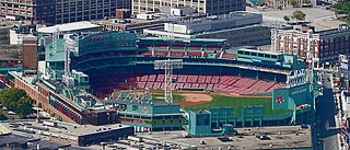
| Kuvaus | 19:29, 6 September 2006 . . Aido2002 . . 1648×704 (610,487 bytes) (Photo taken by Aidan Siegel. I took this photo from the Skywalk at the top of Prudential Tower. The license I released it under says that anyone may use the photo, as long as they give me credit for the photo, and if you edit this photo, you must still give me credit for taking the original one. However, I may waive this license, if you email me (see my user:aido2002, and tell me what you want it for. If you want it for a cause that I wish to waive this for, I will.) | |||
| Päiväys | Commons upload by UCinternational 04:41, 3 October 2006 (UTC) | |||
| Lähde | Originally from en.wikipedia; description page is (was) here | |||
| Tekijä | Aidan Siegel | |||
| Käyttöoikeus (Tämän tiedoston uudelleenkäyttö) |
Tämä tiedosto on lisensoitu Creative Commons Nimeä-JaaSamoin 3.0 Ei sovitettu -lisenssillä.
|
| Kohteen sijainti | | Tämä ja muut kuvat kartalla: OpenStreetMap |
|---|
}
Tiedoston historia
Päiväystä napsauttamalla näet, millainen tiedosto oli kyseisellä hetkellä.
| Päiväys | Pienoiskuva | Koko | Käyttäjä | Kommentti | |
|---|---|---|---|---|---|
| nykyinen | 1. tammikuuta 2008 kello 20.28 | | 1 648 × 704 (683 KiB) | Aido2002~commonswiki | Retouched image--sharpened, saturated, etc. If it looks bad at low res, I'll revert. |
| 3. lokakuuta 2006 kello 07.41 |  | 1 648 × 704 (596 KiB) | UCinternational | {{Information||Description = 19:29, 6 September 2006 . . Aido2002 . . 1648×704 (610,487 bytes) ''(Photo taken by Aidan Siegel. I took this photo from the Skywalk at the top of Prudential Tower. The liscense |
Tiedoston käyttö
Seuraava sivu käyttää tätä tiedostoa:
Tiedoston järjestelmänlaajuinen käyttö
Seuraavat muut wikit käyttävät tätä tiedostoa:
- Käyttö kohteessa ar.wikipedia.org
- Käyttö kohteessa azb.wikipedia.org
- Käyttö kohteessa ceb.wikipedia.org
- Käyttö kohteessa de.wikipedia.org
- Käyttö kohteessa en.wikipedia.org
- Käyttö kohteessa es.wikipedia.org
- Käyttö kohteessa fa.wikipedia.org
- Käyttö kohteessa fr.wikipedia.org
- Käyttö kohteessa he.wikipedia.org
- Käyttö kohteessa is.wikipedia.org
- Käyttö kohteessa ja.wikipedia.org
- Käyttö kohteessa ko.wikipedia.org
- Käyttö kohteessa mn.wikipedia.org
- Käyttö kohteessa pl.wikipedia.org
- Käyttö kohteessa uk.wikipedia.org
- Käyttö kohteessa www.wikidata.org