Tiedosto:Cheshire UK locator map 2010.svg
Siirry navigaatioon
Siirry hakuun

Tämän PNG-esikatselun koko koskien SVG-tiedostoa: 494 × 600 kuvapistettä. Muut resoluutiot: 198 × 240 kuvapistettä | 395 × 480 kuvapistettä | 633 × 768 kuvapistettä | 843 × 1 024 kuvapistettä | 1 687 × 2 048 kuvapistettä | 1 108 × 1 345 kuvapistettä.
Alkuperäinen tiedosto (SVG-tiedosto; oletustarkkuus 1 108 × 1 345 kuvapistettä; tiedostokoko 302 KiB)
| Tämä tiedosto on tiedostotietokanta Wikimedia Commonsista. Tiedot kuvaussivulta näkyvät alla. |  |
Tiedoston kuvaussivu Commonsissa |
Yhteenveto
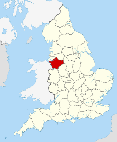
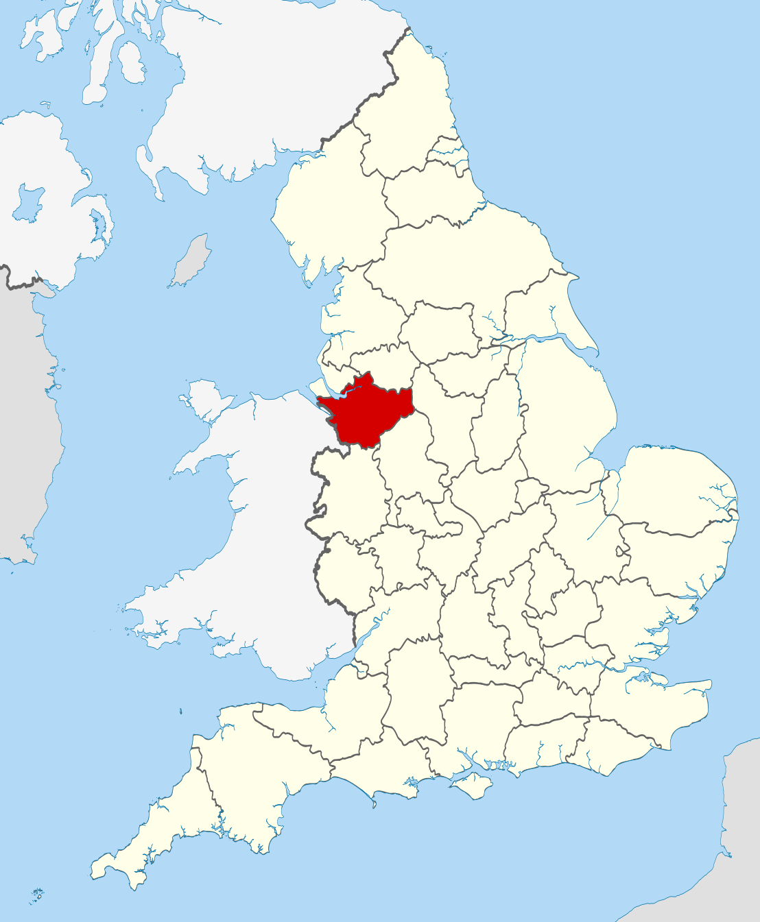
| Kuvaus | Location of the ceremonial county of Cheshire within England. |
| Päiväys | |
| Lähde |
National Geospatial-Intelligence Agency
|
| Tekijä | Nilfanion |
Lisenssi
Minä, tämän teoksen tekijänoikeuksien haltija, julkaisen täten tämän teoksen seuraavilla lisensseillä:
Tämä tiedosto on lisensoitu Creative Commons Nimeä-JaaSamoin 3.0 Ei sovitettu -lisenssillä.
- Voit:
- jakaa – kopioida, levittää ja esittää teosta
- remiksata – valmistaa muutettuja teoksia
- Seuraavilla ehdoilla:
- nimeäminen – Sinun on mainittava lähde asianmukaisesti, tarjottava linkki lisenssiin sekä merkittävä, mikäli olet tehnyt muutoksia. Voit tehdä yllä olevan millä tahansa kohtuullisella tavalla, mutta et siten, että annat ymmärtää lisenssinantajan suosittelevan sinua tai teoksen käyttöäsi.
- jaa samoin – Jos muutat tai perustat tähän työhön, voit jakaa tuloksena syntyvää työtä vain tällä tai tämän kaltaisella lisenssillä.

|
Voit kopioida, levittää ja/tai muuttaa tätä asiakirjaa GNU Free Documentation License -lisenssin version 1.2 tai minkä tahansa Free Software Foundationin julkaiseman myöhemmän version ehtojen alaisena; ei koske muuttumattomia kohtia, etukannen tekstejä eikä takakannen tekstejä. Kopio tästä lisenssistä on saatavilla osiossa GNU Free Documentation License. |
Voit valita haluamasi lisenssin.

|
This is one of the images forming part of the Valued image set: Locator maps of the Ceremonial counties of England on Wikimedia Commons. The image set has been assessed under the valued image set criteria and is considered the most valued set on Commons within the scope:
Locator maps of the Ceremonial counties of England
You can see its nomination at Commons:Valued image candidates/Locator maps of English ceremonial counties. |
Tiedoston historia
Päiväystä napsauttamalla näet, millainen tiedosto oli kyseisellä hetkellä.
| Päiväys | Pienoiskuva | Koko | Käyttäjä | Kommentti | |
|---|---|---|---|---|---|
| nykyinen | 24. marraskuuta 2010 kello 01.31 | | 1 108 × 1 345 (302 KiB) | Nilfanion | == Summary == {{Information |Description=Location of the ceremonial county of Cheshire within England. |Source=Ordnance Survey [https://www.ordnancesurvey.co.uk/opendatadownload/products.html OpenData]: *County boundar |
Tiedoston käyttö
Seuraavat 2 sivua käyttävät tätä tiedostoa:
Tiedoston järjestelmänlaajuinen käyttö
Seuraavat muut wikit käyttävät tätä tiedostoa:
- Käyttö kohteessa af.wikipedia.org
- Käyttö kohteessa an.wikipedia.org
- Käyttö kohteessa ar.wikipedia.org
- Käyttö kohteessa arz.wikipedia.org
- Käyttö kohteessa ast.wikipedia.org
- Käyttö kohteessa be-tarask.wikipedia.org
- Käyttö kohteessa be.wikipedia.org
- Käyttö kohteessa bg.wikipedia.org
- Käyttö kohteessa br.wikipedia.org
- Käyttö kohteessa ca.wikipedia.org
- Käyttö kohteessa ceb.wikipedia.org
- Käyttö kohteessa cs.wikipedia.org
- Käyttö kohteessa de.wikipedia.org
- Käyttö kohteessa en.wikipedia.org
- Cheshire
- Gawsworth
- Langley, Cheshire
- Martinscroft
- Croft, Cheshire
- Birchwood Forest Park
- Culcheth Linear Park
- Lymm Dam
- Westy
- Bruche, Warrington
- Kerridge
- River Bollin
- Ollerton, Cheshire
- Wirral Hundred
- Tytherington, Cheshire
- Whiston Rural District
- Englesea-Brook
- Wilderspool
- Hermitage Green
- Lache
- Siddington, Cheshire
- Hough Green
- Ness Botanic Gardens
- Adlington, Cheshire
- Risley, Warrington
- River Lily
- Orford Park
- Chelford
- Template:Cheshire-geo-stub
- Agden, Cheshire West and Chester
- Agden, Cheshire East
- Aldersey
- Chester Castle (parish)
- Smallwood, Cheshire
- Cuddington Heath
Näytä lisää tämän tiedoston järjestelmänlaajuista käyttöä.