Tiedosto:King-map.jpg
Siirry navigaatioon
Siirry hakuun
Tarkempaa kuvaa ei ole saatavilla.
King-map.jpg (652 × 315 kuvapistettä, 43 KiB, MIME-tyyppi: image/jpeg)
| Tämä tiedosto on tiedostotietokanta Wikimedia Commonsista. Tiedot kuvaussivulta näkyvät alla. |  |
Tiedoston kuvaussivu Commonsissa |
| Kuvaus |
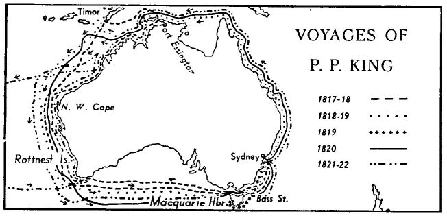
English: Map of the explorer's route in Australia.
Español: Mapa de las rutas de exploración de Phillip Parker King en Australia. |
|||||||||||||||||||||
| Lähde |
Public domain map from Project Gutenberg Australia, [1] |
|||||||||||||||||||||
| Tekijä | Phillip Parker King (1791-1856) | |||||||||||||||||||||
| Käyttöoikeus (Tämän tiedoston uudelleenkäyttö) |
|
|||||||||||||||||||||

Tiedoston historia
Päiväystä napsauttamalla näet, millainen tiedosto oli kyseisellä hetkellä.
| Päiväys | Pienoiskuva | Koko | Käyttäjä | Kommentti | |
|---|---|---|---|---|---|
| nykyinen | 17. toukokuuta 2007 kello 12.04 | | 652 × 315 (43 KiB) | Roke~commonswiki | {{Information |Description=Map of the explorer's route in Australia. {{PD-Australia}} |Source=Public domain map from Project Gutenberg Australia, [http://gutenberg.net.au/explorers.html#exploretimeline] - follow the 'map' link for the explorer. |Date= |A |
Tiedoston käyttö
Seuraava sivu käyttää tätä tiedostoa:
Tiedoston järjestelmänlaajuinen käyttö
Seuraavat muut wikit käyttävät tätä tiedostoa:
- Käyttö kohteessa bg.wikipedia.org
- Käyttö kohteessa de.wikipedia.org
- Käyttö kohteessa en.wikipedia.org
- Käyttö kohteessa eo.wikipedia.org
- Käyttö kohteessa es.wikipedia.org
- Käyttö kohteessa fr.wikipedia.org
- Käyttö kohteessa it.wikipedia.org
- Käyttö kohteessa nl.wikipedia.org
- Käyttö kohteessa ru.wikipedia.org