Tiedosto:Argentina location map.svg
Siirry navigaatioon
Siirry hakuun

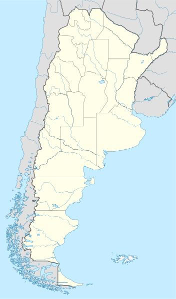
Tämän PNG-esikatselun koko koskien SVG-tiedostoa: 352 × 599 kuvapistettä. Muut resoluutiot: 141 × 240 kuvapistettä | 282 × 480 kuvapistettä | 451 × 768 kuvapistettä | 602 × 1 024 kuvapistettä | 1 204 × 2 048 kuvapistettä | 1 418 × 2 412 kuvapistettä.
Alkuperäinen tiedosto (SVG-tiedosto; oletustarkkuus 1 418 × 2 412 kuvapistettä; tiedostokoko 1,03 MiB)
| Tämä tiedosto on tiedostotietokanta Wikimedia Commonsista. Tiedot kuvaussivulta näkyvät alla. |  |
Tiedoston kuvaussivu Commonsissa |
Yhteenveto
.svg)
.svg)

|
Saksankielisen Wikipedian projekti Kartenwerkstatt on parantanut tätä karttaa. Myös sinä voit ehdottaa jotakin karttaa parannettavaksi.
|
Lisenssi
Minä, tämän teoksen tekijänoikeuksien haltija, julkaisen täten tämän teoksen seuraavilla lisensseillä:

|
Voit kopioida, levittää ja/tai muuttaa tätä asiakirjaa GNU Free Documentation License -lisenssin version 1.2 tai minkä tahansa Free Software Foundationin julkaiseman myöhemmän version ehtojen alaisena; ei koske muuttumattomia kohtia, etukannen tekstejä eikä takakannen tekstejä. Kopio tästä lisenssistä on saatavilla osiossa GNU Free Documentation License. |
Tämä tiedosto on lisensoitu Creative Commons Nimeä-JaaSamoin 3.0 Ei sovitettu -lisenssillä.
- Voit:
- jakaa – kopioida, levittää ja esittää teosta
- remiksata – valmistaa muutettuja teoksia
- Seuraavilla ehdoilla:
- nimeäminen – Sinun on mainittava lähde asianmukaisesti, tarjottava linkki lisenssiin sekä merkittävä, mikäli olet tehnyt muutoksia. Voit tehdä yllä olevan millä tahansa kohtuullisella tavalla, mutta et siten, että annat ymmärtää lisenssinantajan suosittelevan sinua tai teoksen käyttöäsi.
- jaa samoin – Jos muutat tai perustat tähän työhön, voit jakaa tuloksena syntyvää työtä vain tällä tai tämän kaltaisella lisenssillä.
Voit valita haluamasi lisenssin.
Tiedoston historia
Päiväystä napsauttamalla näet, millainen tiedosto oli kyseisellä hetkellä.
| Päiväys | Pienoiskuva | Koko | Käyttäjä | Kommentti | |
|---|---|---|---|---|---|
| nykyinen | 11. elokuuta 2022 kello 18.26 | | 1 418 × 2 412 (1,03 MiB) | Janitoalevic | Reverted to version as of 02:18, 25 May 2021 (UTC) |
| 9. toukokuuta 2022 kello 03.27 |  | 1 418 × 2 412 (1,51 MiB) | Buttons0603 | Reverted to version as of 20:33, 29 January 2021 (UTC) see below | |
| 25. toukokuuta 2021 kello 05.18 |  | 1 418 × 2 412 (1,03 MiB) | MinervaAustral | Reverted to version as of 03:37, 24 November 2018 (UTC) | |
| 29. tammikuuta 2021 kello 23.33 |  | 1 418 × 2 412 (1,51 MiB) | Buttons0603 | Reverted to version as of 13:13, 23 November 2018 (UTC) There is already a version with the Falklands in white at File:Argentina location map (+Falkland).svg for when such a map is needed. | |
| 24. marraskuuta 2018 kello 06.37 |  | 1 418 × 2 412 (1,03 MiB) | Cacen Gymraeg | Reverted to version as of 01:43, 6 November 2017 (UTC). Added claim territories (neutral point of view) | |
| 23. marraskuuta 2018 kello 16.13 |  | 1 418 × 2 412 (1,51 MiB) | Mr. James Dimsey | Reverted to version as of 23:25, 9 October 2015 (UTC) | |
| 6. marraskuuta 2017 kello 04.43 |  | 1 418 × 2 412 (1,03 MiB) | Janitoalevic | Added Fontana and Plata Lake. | |
| 6. marraskuuta 2017 kello 04.37 |  | 1 418 × 2 412 (1,02 MiB) | Janitoalevic | Fixed provincial and international borders. | |
| 26. maaliskuuta 2016 kello 00.36 |  | 1 418 × 2 412 (997 KiB) | Janitoalevic | Added all the Disputed Territories | |
| 21. maaliskuuta 2016 kello 22.00 |  | 1 418 × 2 412 (994 KiB) | Gustavo Girardelli | Detalles. |
.svg)
Tiedoston käyttö
Seuraavat 38 sivua käyttävät tätä tiedostoa:
- Avellaneda
- Buenos Aires
- Catamarca
- Colón (Entre Ríos)
- Concordia (Entre Ríos)
- Copa América 2011
- Corrientes
- Córdoba (Argentiina)
- Formosa (Argentiina)
- General Roca
- Gualeguaychú
- La Plata
- La Rioja (Argentiina)
- Mar del Plata
- Mendoza
- Neuquén
- Olivos (Argentiina)
- Paraná (Argentiina)
- Posadas
- Rawson (Argentiina)
- Resistencia
- Rosario (Argentiina)
- Río Gallegos
- Salta
- San Carlos de Bariloche
- San Ignacio Miní
- San Juan (Argentiina)
- San Luis (Argentiina)
- San Miguel de Tucumán
- San Salvador de Jujuy
- Santa Fe (Argentiina)
- Santa Rosa (Argentiina)
- Santiago del Estero
- Tres Arroyos
- Ushuaia
- Viedma
- Käyttäjä:Paju/Hiekkalaatikko2
- Malline:Sijaintikartta Argentiina
Tiedoston järjestelmänlaajuinen käyttö
Seuraavat muut wikit käyttävät tätä tiedostoa:
- Käyttö kohteessa af.wikipedia.org
- Comodoro Rivadavia
- Mar del Plata
- Bariloche
- La Plata
- Villa General Belgrano
- FIFA Sokker-Wêreldbekertoernooi in 1978
- Balcarce
- Sarmiento
- Sjabloon:Liggingkaart Argentinië
- Monserrat, Buenos Aires
- Aconcagua
- Ojos del Salado
- Los Toldos
- Coloradorivier (Argentinië)
- Rawson
- Ministro Pistarini Internasionale Lughawe
- Käyttö kohteessa an.wikipedia.org
- Käyttö kohteessa ar.wikipedia.org
- Käyttö kohteessa ast.wikipedia.org
- Buenos Aires
- Abbott
- Agote (Buenos Aires)
- La Plata
- Partido de La Plata
- Abasto (La Plata)
- Ángel Etcheverry
- Arturo Seguí
- City Bell
- Joaquín Gorina
- José Hernández (Buenos Aires)
- Manuel B. Gonnet
- Ringuelet
- Tolosa (Buenos Aires)
- Villa Elvira
- Ignacio Correas
- El Peligro (La Plata)
- San Carlos (Buenos Aires)
- San Lorenzo (Buenos Aires)
- Ríu de la Plata
- Mendoza (Arxentina)
- Juan Tronconi
Näytä lisää tämän tiedoston järjestelmänlaajuista käyttöä.